Showing posts with label USA - North Carolina. Show all posts

Friday, July 19, 2013

U.S.A. - North Carolina


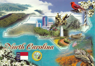
NORTH CAROLINA FUN FACTS
Capital : Raleigh
Area : 48,843 square miles
Statehood : Nov. 21, 1789 (12th state admitted)
Mottos : Esse quam videri (to be rather than to seem)
Song : "The Old North State"
State Bird : Cardinal
State Tree : Long Leaf Pine
State Flower : Dogwood

Sent by Tiffany from Raleigh, North Carolina, USA.


Monday, July 15, 2013

U.S.A. - North Carolina - Raleigh


RALEIGH, NORTH CAROLINA
Raleigh was established as the capital of North Carolina in 1792 and this beautiful city is now a focal point of governmental educational, commercial, and social activity in the state.

Sent by Tiffany from Raleigh, North Carolina, USA.

Raleigh (/ˈrɔːli/; raw-lee) is the capital and the second largest city in the state of North Carolina as well as the seat of Wake County. Raleigh is known as the "City of Oaks" for its many oak trees, which line the streets in the heart of the city. According to the U.S. Census Bureau, the city's 2011 estimated population was 416,468, over an area of 142.8 square miles (370 km2), making Raleigh currently the 42nd most populous city in the United States. It is also one of the fastest-growing cities in the country. The city of Raleigh is named after Sir Walter Raleigh, who established the lost Roanoke Colony on Roanoke Island in present-day Dare County, North Carolina.
Raleigh, Durham, and Chapel Hill make up the three primary cities of the Research Triangle metropolitan region. The regional nickname of "The Triangle" originated after the 1959 creation of the Research Triangle Park, primarily located in Durham County, roughly midway between the cities of Raleigh and Chapel Hill, and three major research universities of North Carolina State University, Duke University, and the University of North Carolina at Chapel Hill. The Research Triangle region encompasses the U.S. Census Bureau's Combined Statistical Area (CSA) of Raleigh-Durham-Chapel Hill in the central Piedmont region of North Carolina. As of 2012 Census Estimate the population of the Raleigh-Durham-Chapel Hill CSA was 1,998,808. The Raleigh Metropolitan Statistical Area (MSA) as of 2012 Census Estimate was 1,188,564. (read further)


Thursday, June 27, 2013

U.S.A. - North Carolina - Wright Brothers National Memorial


Sent by Dayton Aviation Heritage National Historical Park.

Wright Brothers National Memorial, located in Kill Devil Hills, North Carolina, commemorates the first successful, sustained, powered flights in a heavier-than-air machine. From 1900 to 1903, Wilbur and Orville Wright came here from Dayton, Ohio, based on information from the U.S. Weather Bureau about the area's steady winds. They also valued the privacy provided by this location, which in the early twentieth century was remote from major population centers. (read further)


Monday, August 6, 2012

USA - Tennessee/North Carolina - Great Smoky Mountains National Park (7) - Mount Leconte


LeConte Lodge - A rustic hiking lodge atop Mt. LeConte in the Great Smoky Mountains National Park. Elevation 6593'.
LeConte Lodge is an authorized concessioner of the National Park Service.

Sent by John who visited Mount LeConte.


Sunday, July 8, 2012

USA - North Carolina - Waxhaw


WAXHAW, NORTH CAROLINA
Originally called the "Waxhaw Settlement", the area is named for its first inhabitants, the Waxhaw Indians. Near the birthplace of Andrew Jackson is the pictured Andrew Jackson memorial Museum of the Old Waxhaws.


Sent by Avery, a postcrosser from North Carolina, USA.


This is from Wikipedia : Waxhaw is a town located in Union County, North Carolina. The population was 2,627 at the 2000 Census.

Waxhaw is located at 34°55′42″N 80°44′41″W (3$4.928201, -80.744835).
According to the United States Census Bureau, the town has a total area of 2.8 square miles (7.3 km2), all of it land. Waxhaw is located north of Lancaster, South Carolina and lies about 12 miles south of Charlotte.
Waxhaw is located in a historic region called the Waxhaws, named after the indigenous Native American tribe that lived in the territory in historic times. It is in the Piedmont region of North Carolina, which is wooded with rolling hills. This region is where goldwas first discovered in the United States. The Howie Gold Mine is not far from the city limits.
Waxhaw takes its name from the Waxhaws, named after the historic American Native American tribe that inhabited the region. The community was settled by European-Americans in the mid-18th century, of mostly German and Scots-Irish origin. They became subsistence farmers and were known for being independent. Andrew Jackson, seventh President of the United States, was born nearby in 1767. There is some disagreement as to which of the Carolinas was his birthplace, due to the proximity of the border.
The arrival of the railroad in 1901, with access to the markets of Atlanta, helped the town reach prosperity. The tracks were laid directly through the center of town, showing the importance of the railroad. They remain on the street, now bordered by a green, grassy strip dividing the rows of stores on each side.
Beginning in the late 19th century, the community was developed with cotton mills for manufacturing textiles. The railroad helped increase access for its products. Cotton manufacturing was important to the region through the 1940s. Postwar changes in the economy, with shifts of the textile industry to jobs to other areas and out of the country, required the community to adapt to new conditions.
Waxhaw has evolved as an antique and fine dining center. Its Small Town Main Street committee is working on an integrated approach to developing and marketing the historic center of town. The Town currently has dozens of specialty shops and dining ranging from mom & pop restaurants to fine dining bistros. The Waxhaw Historic District is on theNational Register of Historic Places. It includes retail businesses as well as architecturally significant houses near the center of town.
Residents and town government are working on additional improvement plans. The Town Park is located in the downtown area, as is a Skate Park for youths and skateboarding. New housing has been built along NC 75 to the east and west of town, as well as NC 16 (Providence Road) to the north.
Near Waxhaw is Cane Creek Park, a 1,050-acre (4.2 km2) park, featuring scenic areas and recreation activities. The facility, on Harkey Road south of Waxhaw, was a cooperative venture between Union County, the Union Conservation District and the Soil Conservation Service of the U.S. Department of Agriculture.


Monday, February 27, 2012

USA - North Carolina - Mapcard (2)


NORTH CAROLINA
The Tarheel State

State Bird : Cardinal
State Flower : Dogwood

Sent by Debbie, a postcrosser from North Carolina, USA.

This is from Wikipeedia : Tar Heel (or Tarheel) is a nickname applied to the state and inhabitants of North Carolina as well as the nickname of the University of North Carolina athletic teams, students, alumni, and fans.

The exact etymology of the nickname is unknown, but most experts believe its roots come from the fact that tar, pitch and turpentine created from the vast pine forests were one of North Carolina's most important exports early in the state's history.

Because the exact history of the term is unknown, a number of legends have developed to explain it. Many believe it to be a nickname given during the U.S. Civil War, because of the state's importance on the Confederate side, and the fact that the troops "stuck to their ranks like they had tar on their heels".

The term "Tar Heel" gained popularity during the Civil War.

In its early years as a colony, North Carolina settlements became an important source of the naval stores tar, pitch, and turpentine especially for the English navy. Tar and pitch were largely used to paint the bottom of wooden British ships in order to both seal the ship and to prevent shipworms from damaging the hull.

At one time, an estimated 100,000 barrels (16,000 m3) of tar and pitch were shipped annually to England. After 1824, North Carolina became the leader in the United States for naval stores. By the Civil War, North Carolina had more than 1600 turpentine distilleries, and two thirds of all turpentine in the United States came from North Carolina and one-half from the counties of Bladen and New Hanover.

Historians Hugh Lefler and Albert Newsome claim in North Carolina: the History of a Southern State (3rd edition, 1973) that North Carolina led the world in production of naval stores, from about 1720 to 1870.

At the time, tar was created by piling up pine logs and burning them until hot oil seeped out from a canal. The vast production of tar from North Carolina led many, including Walt Whitman, to give the derisive nickname of "Tarboilers" to the residents of North Carolina. North Carolina was nicknamed the "Tar and Turpentine State" because of this industry.

Somehow, these terms evolved until the nickname Tar Heel was used to refer to residents of North Carolina and gained prominence during the American Civil War. During this time, the nickname Tar Heel was a pejorative, but starting around 1865, the term began to be used as a source of pride.

In 1893, the students of the University of North Carolina founded a newspaper and christened it The Tar Heel, which was later renamed The Daily Tar Heel. By the early 1900s the term was embraced by many as a non-derisive term for North Carolinians by those from inside and outside the state of North Carolina.

Saturday, January 21, 2012

USA - North Carolina - State Bird & State Flower


The Cardinal and Dogwood Blossom provide a colorful complementary contrast as the official bird and flower of this marvelous friendly state.

Sent by John from Tennessee, USA.

Saturday, September 24, 2011

USA - Tennessee/North Carolina - Great Smoky Mountains National Park (5)


GREAT SMOKY MOUNTAINS NATIONAL PARK
The Great Smoky Montains are named for the blue haze that often surrounds them.

Sent by John from Tenenessee who works in this national park. Thanks for the GSMNP postmark.


Wednesday, July 27, 2011

USA - North Carolina - Mt. Mitchell State Park


Rising 6,684, Mt. Mitchel is the highest peak east of the Mississippi River.

Sent by Pat, a WiP partner from USA.

This is from Wikipedia : Mount Mitchell State Park is a North Carolina state park in Yancey County, North Carolina in the United States. Established in 1915 by the state legislature, it became the first state park of North Carolina. By doing so, it also established the North Carolina State Parks System within the same bill.

Located off of NC 128 and the Blue Ridge Parkway near Burnsville, North Carolina, it includes the peak of Mount Mitchell, the highest peak east of the Mississippi River. From the parking lot you can take a short hike to the summit which includes an observation tower and the grave of Elisha Mitchell, the professor who first noted the mountain's height. The old observation tower was torn down in Early October 2006. The trail leading to the summit has been paved, and a new observation platform was constructed and opened to the public in January 2009. The summit also features an exhibit hall with information about the mountain's natural, cultural and historical heritage.

In addition to Mount Mitchell itself, the park encompasses several other peaks which top out at over 6000' in elevation, including Mount Hallback, Mount Craig (just 37 feet (11 m) shy of Mount Mitchell in Elevation and the second highest peak east of the Mississippi River), Big Tom and Balsam Cone. Trails lead to all these summits save Mount Hallback, and their exploration takes visitors away from the crowds on Mount Mitchell but to places similarly spectacular. About 8 miles (13 km) of trails exist within the park in all.

Another popular destination reachable by trail within the park is Camp Alice, at an elevation of 5800' south of the summit of Mount Mitchell. This historic site is the location of a logging and, later, Civilian Conservation Corps tourist camp at the terminus of the old Mount Mitchell toll road. Lower Creek flows across the main trail at this point and it is one of the highest elevation perennial streams in the Appalachians, flowing through the Spruce-Fir forest. Openings here in the forest surrounded by evergreens resemble such openings near treeline in higher mountain ranges.

The park also serves as the finish line for The Assault on Mount Mitchell and the midpoint for the Mount Mitchell Challenge ultramarathon.

Thursday, June 16, 2011

USA - Tennessee/North Carolina - Great Smoky Mountains National Park (4)


GREAT SMOKY MOUNTAINS NATIONAL PARK, TENNESSEE.
Lacy and white, the dogwood is predominate on the mountainsides in springtime.

Sent by Karyn, a WiP partner from USA.

This is from UNESCO : Great Smoky Mountains National Park is the most important natural area in the eastern United States and is of world importance as an example of temperate deciduous hardwood forest and thus an outstanding example of the diverse Arcto-Tertiary geoflora era, having a high number of temperate species with some rich mixed stands. During Pleistocene glaciation it was the major North American refuge for temperate and boreal species of flora and fauna, so has a large number of endemic species as well as an extremely rich species composition. With 130 species of tree, it has almost as many species as all of Europe. This has resulted in a rich vegetation mosaic. It harbours many endangered species of animals, and has possibly the greatest diversity of salamanders in the world; it is a centre of endemism for North American molluscs.

The dominant topographic feature of the park is the range of the Great Smoky Mountains with 16 peaks over 1,829m. Lesser ridges form radiating spurs from the central ridgeline. In broad aspect, the topography of the park consists of moderately sharp-crested, steep-sided ridges separated by deep V-shaped valleys. Many of the mountain ridges branch and subdivide creating a complex of drainage systems with many fast-flowing clear mountain streams. The park contains 22 major watersheds and the water table is near the surface in almost all sections. Precambrian metamorphic rocks consisting of gneisses and schists, and sedimentary rocks.

The vegetation changes continuously with elevation, slope aspect and soil moisture patterns. Five species are officially listed as endangered on the Fish and Wildlife Service List of Candidate Endangered Plants. A diverse fauna occurs including at least 50 native animals, reflecting the richness of the flora. Several species of bat and over 200 species of bird inhabit the park.

Heavy precipitation and numerous streams make the mountains ideal for a wide variety of amphibian species; the park also contains a diversity of invertebrates, over 70 species of native fish, spiders, insects and other arthropods, and over 100 species of caddisfly and stonefly.

Archaeological sites support the theory that prehistoric people (15,000 years ago) were hunters and gatherers. Present historical and cultural interpretation in the park is based mainly on the structures dating from the mid-1800s to 1920, including the finest collection of log buildings in the United States.

The park contains evidence of four pre-Columbian Indian cultures: Mississippian, Woodland, Archaic and palaeo-Indian. The early Woodland culture period is of special archaeological importance because it shows the first evidence of organized horticulture in North America, with primitive agriculture on river floodplains. These Indians used the caves for shelters and chipped gypsum and mirabilite off the walls: more than 150 archaeological sites have been identified within the national park. Saltpeter deposits were discovered on the cave walls and this valuable nitrate was removed and sent to be processed in gunpowder factories between 1809 and 1819. Three churches and 14 cemeteries still exist in the park and are used by the public.

There are no permanent inhabitants in the core area. About 240 people live in the buffer zones with a further 1,500 in the transition area. Only 25% of the population is considered urban and no significant increase in urbanization is expected in the near future. Most people are engaged in agriculture, tourism or service industries.

Wednesday, October 20, 2010

USA - Tennessee/North Carolina - The Great Smoky Mountains National Park (3)


THE GREAT SMOKY MOUNTAINS
The Great Smoky Mountains National Park is the most visited place in the United States, and straddles the border between North Carolina and Tennessee. With deep gorges, peaceful streams, abundance of flora and fauna, and great forests, the National Park is a panorama of beauty.

Sent by Karen, a Swap-Bot partner from USA.

This is from UNESCO : Stretching over more than 200,000 ha, this exceptionally beautiful park is home to more than 3,500 plant species, including almost as many trees (130 natural species) as in all of Europe. Many endangered animal species are also found there, including what is probably the greatest variety of salamanders in the world. Since the park is relatively untouched, it gives an idea of temperate flora before the influence of humankind.

Monday, August 16, 2010

USA - North Carolina - Outer Banks - Mapcard


Welcome to the Outer Banks.

Sent by 나비, a postcrosser from USA.

This is from Wikipedia : The Outer Banks is a 200-mile (320-km) long string of narrow barrier islands off the coast of North Carolina, beginning in the southeastern corner of Virginia Beach on the east coast of the United States. They cover approximately half the northern North Carolina coastline, separating the Currituck Sound, Albemarle Sound, and Pamlico Sound from the Atlantic Ocean.

The Outer Banks is a major tourist destination and is known for its temperate climate and wide expanse of open beachfront. The Cape Hatteras National Seashore has four campgrounds where visitors may camp.

The Wright brothers' first flight in a powered, heavier-than-air vehicle took place on the Outer Banks on December 17, 1903, at Kill Devil Hills near the seafront town of Kitty Hawk. The Wright Brothers National Monument commemorates the historic flights, and First Flight Airport is a small, general-aviation airfield located there.

The English Roanoke Colony—where the first person of English descent, Virginia Dare, was born on American soil—vanished from Roanoke Island in 1587. The Lost Colony, written and performed to commemorate the original colonists, is the longest running outdoor drama in the United States and its theater acts as a cultural focal point for much of the Outer Banks.

The treacherous seas off the Outer Banks and the large number of shipwrecks that have occurred there have given these seas the nickname Graveyard of the Atlantic. The Graveyard of the Atlantic Museum is located in Hatteras Village near the United States Coast Guard facility and Hatteras ferry.

Tuesday, June 15, 2010

USA - Tennessee/North Carolina - Great Smoky Mountains National Park (2)


Greetings from the Great Smoky Mountains!

Sent by Jackie S. from USA.

This is from Wikipedia : Great Smoky Mountains National Park is a United States National Park that straddles the ridgeline of the Great Smoky Mountains, part of the Blue Ridge Mountains, which are a division of the larger Appalachian Mountain chain. The border between Tennessee and North Carolina runs northeast to southwest through the centerline of the park. It is the most visited national park in the United States. On its route from Maine to Georgia, the Appalachian Trail also passes through the center of the park. The park was chartered by the United States Congress in 1934 and officially dedicated by President Franklin Delano Roosevelt in 1940. It encompasses 814 square miles (2,108 km²), making it one of the largest protected areas in the eastern United States. The main park entrances are located along U.S. Highway 441 (Newfound Gap Road) at the towns of Gatlinburg, Tennessee, and Cherokee, North Carolina. It was the first national park whose land and other costs were paid for in part with federal funds; previous parks were funded wholly with state money or private funds.

Friday, May 7, 2010

USA - North Carolina - Charlotte


A beautiful day in Charlotte, North Carolina.

The world is actually small. You met once and you'll meet again in another place. This is what happenned to me and Natalie and Kyra. We met before in Facebook and swapped two postcards. Now we met again in Postcrossing.

Thanks Natalie and Kyra :)

Please check her postcards blog HERE

Wednesday, April 28, 2010

USA - North Carolina - Charlotte


Charlotte was named in honor of Queen Charlotte, wife of George III, and is often referred to as the Queen City. Charlotte is the largest city in the two Carolinas.

Sent by Natalie and Kyra from Charlotte, North Carolina.

Friday, April 23, 2010

USA - North Carolina - Kill Devil Hills


Wright Brothers National Memorial - Kill Devil Hills, North Carolina.
The Wright Brothers made nearly 1,000 glider flights in 1902, gaining valuable knowledge and experience which would lead the way to their succesful powered flights. In this October 10, 1902 photo, Wilbur Wright, at left and Dan Tate starts Orville Wright on a glider flight.

Sent by loubie, a Swap-Bot partner from England.

This is from Wikipedia : Kill Devil Hills is a town in Dare County, North Carolina, USA. The population was 5,897 at the 2000 census.

Nearby Kitty Hawk is frequently cited as the location of the Wright brothers' first controlled, powered airplane flights on December 17, 1903. The flights actually occurred in Kill Devil Hills.

Wednesday, April 7, 2010

USA - North Carolina - Lighthouses


North Carolina Lighthouses. For centuries, lighthouses have been erected to protect ships and guide them safely away from low shoals. Each lighthouse has individual markings making it readily identifiable from a distance. Advancements in technology have made the lighthouses obsolete, but most are open to the tourists and visitors providing a historic view of times gone by.

Sent by arttxturtle, a frind at TravBuddy who lives in Creedmoor in North Carolina.