Friday, December 6, 2013

Papua New Guinea - National Parliament House


PAPUA NEW GUINEA
National Parliament House

It was sent by an unknown sender. Thank you very much.

The National Parliament of Papua New Guinea is the unicameral national legislature in Papua New Guinea. It was first created in 1964 as the House of Assembly of Papua and New Guinea, but gained its current name with the granting of independence in 1975.
The 109 members of the parliament all serve five-year terms. 89 members are elected from single-member "Open" electorates, which are sometimes referred to as "seats" but are officially known as constituencies. The remaining 20 are elected from single-member "Provincial" electorates, each covering a province-level division: the 18 provinces, the autonomous province of Bougainville (North Solomons), and the National Capital District. Each Provincial member becomes the Governor of the province, unless they take up a ministry, in which case the position of Governor passes to one of the Open members from the province.
From 1964 until 1977 an Optional Preferential Voting System was used. The first past the post system was used from 1977 until 2002. Electoral reforms introduced by former Prime Minister Mekere Morauta introduced Limited Preferential Voting, where voters number their first three preferred candidates. LPV was first used nationally in the 2007 election.
As in other Commonwealth Realms, the party or coalition with the most seats in the parliament is invited by the Governor-General to form a government, and their leader subsequently becomes Prime Minister of Papua New Guinea, with the Prime Minister then appointing his cabinet from fellow members of the parliament.
Papua New Guinea has a fractious political culture and no party in the history of the parliament has yet won majority government. This has meant that negotiations between several parties have been necessary for governments to be formed. New governments are protected by law from votes of no confidence for the first 18 months of their term and in the last 12 months before a national election. More recently, in a move aimed at further minimizing no-confidence motions, then-Prime Minister Mekere Morauta introduced changes that prevented members of the government of the day from voting in favour of such a motion.
There is universal franchise for all citizens over the age of 18, although voting is not compulsory. (Source)


St. Vincent & The Grenadines - Tobago Cays


St. Vincent & The Grenadines
Tobago Cays

Sent by Jay from St. Vincent & The Grenadines.

The Tobago Cays are an archipelago comprising five small uninhabited islands - Petit Rameau, Petit Bateau, Baradol, Petit Tobac and Jamesby - located in the Southern Grenadines. The Tobago Cays are now the key element of the Tobago Cays Marine Park, a national park and wildlife preserve run by the St.Vincent and the Grenadines government. The Tobago Cays Marine Park consists of a 1,400-acre (5.7 km2) sand-bottom lagoon which encompasses four uninhabited cays and the 4 km Horseshoe Reef. While the cays are uninhabited, they are surrounded by the three larger inhabited islands of Union Island, Mayreau and Canouan (read further).


St. Vincent & The Grenadines - Owia Salt Pond


St. Vincent & The Grenadines
Owia Salt Pond

Sent by Jay from St. Vincent & The Grenadines.

Continuously refreshed by waves cascading over the volcanic rock formations that surround the pools, it feels as if you are bathing in an aquarium. Reef fish and even coral formations add colour and life to what is a unique, peaceful and very special natural phenomenon.
The Owia Salt Pond is located on the North Eastern Coast of St. Vincent in the village of Owia which is home to some of the indigenous people of St. Vincent and the Grenadines – the Black Caribs. The salt water pond is sheltered from the sea by the numerous volcanic boulders which surround it.
The two hour drive from Kingstown along the Eastern Coast takes you to this recreation site which occupies a fairly extensive area of well maintained grounds which leads down to the sea where the salt pond is situated. Traditionally, it has been used as a therapeutic bathing pond. (read further)

St. Vincent & The Grenadines - Baleine Falls


St.Vincent & The Grenadines
Baleine Falls

Sent by Jay from St. Vincent & The Grenadines. He is now working with the Ministry of Tourism and he used to live in Malaysia from 2007 till 2009. Terima kasih Jay.

South Korea - Hwaeomsa Temple


Gakhwangjeon (Hall) in Hwaeomsa Temple

Sent by Nurul from Jeju Island, South Korea. Terima kasih banyak-banyak.

Hwaeomsa (Sino-Koreanhwa-eom-sa 華嚴寺, literally "Flower Garland Temple") is a head temple of the Jogye Order of Korean Buddhism. It is located on the slopes of Jiri-san, in Masan-myeon, Gurye County, in the province of Jeollanam-do, South Korea. It was constructed under the Silla dynasty in 544, burned down during the Seven Year War in the 1590s, and rebuilt thereafter.
Four national treasures of South Korea are located within the temple. These include Gakhwangjeon Hall, an ancient stone lantern, and a three-storied stone pagoda supported by four stone lions. There are eight treasures of South Korea such as the Lion Pagoda in front of Wontongjeon Hall. (Source)


Portugal - Madeira - Laurisilva of Madeira


Levadas, Madeira

Sent by Andrew Zino, the CEO of Laurislva of Madeira.

The Laurisilva of Madeira consists of approximately 15,000 ha within the 27,000 ha Madeira Nature Reserve. The site conserves primary laurel forest (laurisilva), a vegetation type that is now confined to the Azores, Madeira and the Canary Islands. The laurisilva on Madeira is the largest area of laurel forest surviving and is in very good condition, with around 90% believed to be primary forest.
Fossil evidence shows that laurisilva flora once covered much of southern Europe in the Tertiary era, 15-40 million years ago, and what is now seen in Madeira is the largest surviving relict of a virtually extinct flora of great interest. As climate change brought about its demise on continental Europe, the ocean-moderated climate of the island groups of the Azores, Madeira and Canary Islands maintained relicts of this previously widespread forest type.
The laurel forest has great ecological value, playing an important role in maintaining the ecological balance of the island. It provides ecological services to the island by protecting the micro-climate and maintaining water supplies by collecting and retaining water. The forest completely covers a series of very steep, V-shaped valleys leading from the plateau and east-west ridge in the centre of the island to the north coast. Ancient trees in the valley bottoms, waterfalls and cliffs provide spectacular scenery. At the higher altitudes, arborescent plants in normally herbaceous genera such as sow-thistle cling to steep cliffs and in the valley bottom giant ferns abound.
The laurisilva of Madeira is notable for its biological diversity with at least 66 vascular plant species endemic to Madeira occurring in the site.
13 liverwort species and 20 moss species are listed as rare or threatened on a European scale; and endemic animals include a species of pigeon (Madeiran long-toed pigeon, which eats the laurel fruits); a lizard species; two species of bat; and endemic subspecies of chaffinch and fire-crest. (Source)


Saturday, October 19, 2013

Nagorno-Karabakh - Monastery of Gandzasar


Republic Mountainous Karabakh
Artsakh, Monastery of Gandzasar XII-XIV

Thanks to Francis Corbett of USA who made an arrangeent with the traveller to Nagorno-Karabakh.


Gandzasar monastery (Armenian: Գանձասարի վանք) is a tenth to thirteenth century Armenian monastery situated in the Mardakert district of de facto Nagorno-Karabakh Republic (de jure: Kalbajar Rayon of Azerbaijan). "Gandzasar" means treasure mountain or hilltop treasure in Armenian. The monastery holds relics believed to belong to St. John the Baptist and his father St Zechariah.
Gandzasar was, from about 1400 until 1816, the residence of the catholicoi of the Catholicosate of Aghvank (Church of Caucasian Albania) under the jurisdiction of the Armenian Apostolic Church.
Gandzasar is now the seat of the Archbishop of Artsakh appointed by the Mother See of Holy Etchmiadzin of the Armenian Apostolic Church. (read further)

NOTE : On 1 January 2024, the Republic of Artsakh was formally dissolved.


Friday, October 11, 2013

South Georgia and the South Sandwich Islands - Grytviken


SOUTH GEORGIA - ANTARCTIC ISLAND
Photographs clockwise from left :
Sir Ernest Shackleton's grave;
Mt. Sugartop above Grytviken;
King penguins and abandoned sealing vessels;
Grytviken Church;
South Georgia Museum and the buildings of the derelict whaling station;
Four ton elephant seal bull with harem.

Sent by Sarah of South Georgia Museum from Grytviken, South Georgia and the South Sandwich Islands

Grytviken (Swedish for "The Pot Cove") is the principal settlement in the British territory of South Georgia in the South Atlantic. It was so named in 1902 by the Swedish surveyor Johan Gunnar Andersson who found old English try pots used to render seal oil at the site. It is the best harbour on the island, consisting of a bay (King Edward Cove) within a bay (Cumberland East Bay). The site is quite sheltered, provides a substantial area of flat land suitable for building, and has a good supply of fresh water. (read further)


South Georgia and the South Sandwich Islands


SOUTH GEORGIA - ANTARCTIC ISLAND
Photographs clockwise from left :
Iceberg;
King penguin above Moraine Fjord;
Wandering albatross displaying;
Macaroni penguins mutually preening;
King penguin with chick;
Unusual blonde fur seal pup;
Background - breeding King penguin colony.

Sent by Sarah of South Georgia Museum from Grytviken, South Georgia and the South Sandwich Islands.

South Georgia and the South Sandwich Islands (SGSSI) is a British overseas territory in the southern Atlantic Ocean. It is a remote and inhospitable collection of islands, consisting of South Georgia and a chain of smaller islands, known as the South Sandwich Islands. South Georgia is 167.4 kilometres (104 mi) long and 1.4 to 37 km (0.9 to 23.0 miles) wide and is by far the largest island in the territory. The South Sandwich Islands lie about 520 kilometres (320 mi) southeast of South Georgia. The total land area of the territory is 3,903 square kilometres (1,507 sq mi).
There is no native population on the islands; the present inhabitants are the British Government Officer, Deputy Postmaster, scientists, and support staff from the British Antarctic Survey who maintain scientific bases at Bird Island and at the capital, King Edward Point, as well as museum staff at nearby Grytviken.
The United Kingdom claimed sovereignty over South Georgia in 1775 and the South Sandwich Islands in 1908. In 1908 the United Kingdom annexed both South Georgia and the South Sandwich Islands. The territory of "South Georgia and the South Sandwich Islands" was formed in 1985; previously it had been governed as part of the Falkland Islands Dependencies. Argentina claimed South Georgia in 1927 and claimed the South Sandwich Islands in 1938.
Argentina maintained a naval station, Corbeta Uruguay on Thule Island in the South Sandwich Islands, from 1976 until 1982 when it was closed by the Royal Navy. The Argentine claim over South Georgia contributed to the 1982 Falklands War, during which Argentine forces briefly occupied the island. Argentina continues to claim sovereignty over South Georgia and the South Sandwich Islands. (Source)


Saturday, October 5, 2013

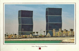
Qatar - Doha


Doha - West Bay Lagoon Plaza

Sent by Salah who visited Qatar in August.

Doha (Arabic: الدوحة‎, ad-Dawḥa or ad-Dōḥa, literally: "the big tree") is the capital city of the state of Qatar.
Located on the coast of the Persian Gulf, it had a population of 998,651 in 2008. Doha is Qatar's largest city, with over 60% of the nation's population residing in Doha or its surrounding suburbs, and is also the economic centre of the country. It is also one of the municipalities of Qatar.
Doha also serves as the seat of government of Qatar. Doha is home to the Education City, an area devoted to research and education. Doha was the site of the first ministerial-level meeting of the Doha Development Round of World Trade Organization negotiations. The city of Doha held the 2006 Asian Games, which was the largest Asian Games ever held. Doha also hosted the 2011 Pan Arab Games and most of the games at the 2011 AFC Asian Cup. Doha hosted the UNFCCC Climate Negotiations (COP 18) December 2012 and will host a large number of the venues for the 2022 FIFA World Cup. The World Petroleum Council held the 20th World Petroleum Conference in Doha in December 2011. (Source)


Martinique - Traditional Costumes


MARTINIQUE
Traditional Costumes.

Sent by Yann from Fort-de-France, Martinique.


Martinique - Traditional Headdresses


MARTINIQUE
Traditional headdresses of Martinique.

Sent by Yann from Fort-de-France, Martinique.


Russia - Chelyabinsk Oblast - Chelyabinsk (1)


Sent by Katya from Chelyabinsk, Russia.

Chelyabinsk (RussianЧелябинскIPA: [tɕɪˈlʲæbʲɪnsk]) is a city and the administrative center of Chelyabinsk Oblast,Russia, located in the northeast of the oblast, 210 kilometers (130 mi) south of Yekaterinburg, just to the east of the Ural Mountains, on the Miass River, on the border of Europe and Asia. Population: 1,130,132 (2010 Census); 1,077,174 (2002 Census); 1,141,777 (1989 Census). (read further)


Australia - South Australia


The flag, Sturt's Desert Pea and Southern Hairy-nosed Wombat are emblems of the State of South Australia. Left, top to bottom : Looking over Adelaide, the capital city, from North Adelaide to the Mt Lofty Ranges; a vineyard in the famed Barossa Valley.

Sent by Terry, a postcrosser from Adelaide, Australia.

South Australia (abbreviated as SA) is a state in the southern central part of Australia. It covers some of the most arid parts of the continent. With a total land area of 983,482 square kilometres (379,725 sq mi), it is the fourth largest of Australia's states and territories.
South Australia shares borders with all of the other mainland states, and with the Northern Territory; it is bordered to the west by Western Australia, to the north by the Northern Territory, to the north-east by Queensland, to the east by New South Wales, to the south-east by Victoria, and to the south by the Great Australian Bight and the Indian Ocean. With over 1.6 million people, the state comprises less than 8% of the Australian population and ranks fifth in population among the states and territories. The majority of its people reside in the state capital, Adelaide, with most of the remainder settled in fertile areas along the south-eastern coast and River Murray. The state's origins are unique in Australia as a freely settled, planned British province, rather than as a convict settlement. Official settlement began on 28 December 1836, when the colony was proclaimed at The Old Gum Tree by Governor John Hindmarsh.
The first settlement to be established was Kingscote, Kangaroo Island, on 26 July 1836, five months before Adelaide was founded. The guiding principle behind settlement was that of systematic colonisation, a theory espoused by Edward Gibbon Wakefield that was later employed by the New Zealand Company. The aim was to establish the province as a centre of civilisation for free immigrants, promising civil liberties and religious tolerance. Although its history is marked by economic hardship, South Australia has remained politically innovative and culturally vibrant. Today, the state is known as a state of festivals and of fine wine. The state's economy centres on the agricultural, manufacturing and mining industries and has an increasingly significant finance sector as well.
South Australia's Governor is Kevin Scarce and its Premier is Jay Weatherill of the Australian Labor Party. (Source)


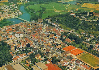
Germany - Bavaria - Burglengenfeld


Burglengenfeld

Sent by Ingrid, a WiP partner from Burglengenfeld, Germany.

Burglengenfeld is a town in the district of Schwandorf, in BavariaGermany. It is situated on the river Naab, 22 km north of Regensburg. (read further)


U.S.A. - California - Sequoia & Kings Canyon National Park (2)


Sequoia National Park
Land of Giants, Sequoia National Park
The establishment of Sequoia National Park in 1890, even in its much smaller form, was a major first step in securing the giant trees and wondrous landscape for future generations. Several annexes and boundary expansions since that time have succeeded in protecting more of the area, but complete success will depend upon our appreciation and protection of the park into the future.

Sent by Sequoia and Kings Canyon National Parks, Three Rivers, California.


U.S.A. - California - Sequoia & Kings Canyon National Parks (1)


SEQUOIA AND KINGS NATIONAL PARKS, CALIFORNIA
The twin national parks of Sequoia and Kings Canyon are located on the southern end of California's Sierra Nevada Mountains. Elevations range from 1,700 feet at Ash Mountain to 14,495 feet at Mount Whitney's summit. Within these parks are found the largest groves of giant sequoia trees and also the largest individual sequoias.

Sent by Sequoia & Kings National Parks, Three Rivers, California.

Sequoia National Park is a national park in the southern Sierra Nevada east of Visalia, California, in the United States. It was established on September 25, 1890. The park spans 404,063 acres (631.35 sq mi; 1,635.18 km2). Encompassing a vertical relief of nearly 13,000 feet (4,000 m), the park contains among its natural resources the highest point in the contiguous 48 United States, Mount Whitney, at 14,505 feet (4,421 m) above sea level. The park is south of and contiguous with Kings Canyon National Park; the two are administered by the National Park Service together.
The park is famous for its giant sequoia trees, including the General Sherman tree, one of the largest trees on Earth. The General Sherman tree grows in the Giant Forest, which contains five out of the ten largest trees in the world. The Giant Forest is connected by the Generals Highway to Kings Canyon National Park's General Grant Grove, home to the General Grant tree among other giant sequoias. The park's giant sequoia forests are part of 202,430 acres (81,921 ha) of old-growth forests shared by Sequoia and Kings Canyon National Parks. Indeed, the parks preserve a landscape that still resembles the southern Sierra Nevada before Euro-American settlement. (read further)


Netherlands - Apeldoorn


Views of Apeldoorn.

Sent by Marieke, a postcrosser from Apeldoorn.

Apeldoorn [ˈaːpəɫdʊːrn] is a municipality and city in the province of Gelderland in the centre of the Netherlands. It is a regional centre. The municipality of Apeldoorn, including villages like BeekbergenLoenen and Hoenderloo, has 157,057 inhabitants (2012). The western half of the municipality lies on the Veluwe ridge, the eastern half lies in the IJssel valley. John Berends of the CDA is the mayor of Apeldoorn. (read further)


U.S.A. - Massachusetts - Mapcard (3)


Massachusetts.

Sent by Cyd, a postcrosser from Massachusetts, USA.


U.S.A. - Idaho - State Flower


IDAHO
A Syringa bush grows along a bank of the Salmon River in Idaho. The Syringa is Idaho's state flower.

Sent by Tracy from Boise, Idaho.

The Syringa (Philadelphus lewisii) was designated the official state flower of Idaho in 1931. Syringa is a woody shrub growing to nine feet tall with with clusters of white, fragrant flowers.

Native American Indians found many uses for the syringa - the wood was used for root digging sticks and to make pipe stems, harpoon shafts, bows, arrows, and snowshoes. The bark and leaves were used to make a soap. (Source)


U.S.A - Nebraska - State Capitol


THE NEBRASKA STATE CAPITOL
LINCOLN, NEBRASKA
The Nebraska State Capitol, with its 400-foot tower, is topped by the 32-foot bronze statue of "The Sower".

Sent by Charlene, from Lincoln, Nebraska.

The Nebraska State Capitol, located in Lincoln, Nebraska, houses the primary executive, judicial, and legislative offices of the U.S. State of Nebraska.
The structure is anchored by a three-story, 437-foot (133 m) square base. This square base houses offices most frequently visited by the public. The second floor (main floor) is home to the Nebraska Supreme Court, the Nebraska Court of Appeals, and the Nebraska Legislature.
From the center of the base, a tower rises 362 feet (110 m), crowned by a gold-tiled dome. The spire—The Sower and its pedestal—add an additional 32 feet (9.8 m) to the building’s height. Common measurements list the capitol at 400 feet (120 m), making it the second-tallest U.S statehouse, surpassed only by the 450-foot (140 m) Louisiana State Capitol.
As the tower was intended for expansion of the Nebraska State Library, the 17-foot (5.2 m) tower floors were originally designed to include loft-like stacks for book storage. By 1925, with government increasing in size, the State of Nebraska decided to redesign the tower to house offices. Tower floors continue to house various offices today.
In total, there are 15 full floor stories in the capitol (three mezzanines also exist within the tower). The 14th floor, Memorial Chamber, is the highest publicly accessible level. At this level, four observatory decks offer views of Lincoln from 245 feet (75 m) above the ground.
Chapter 27.56 of the Lincoln Municipal Code places height restrictions on structures within the designated Capitol Environs District. This code helps to maintain the capitol’s title as the tallest building in Lincoln. The capitol held the title of tallest building in Nebraska until 1969 with the completion of the 478-foot (146 m) Woodmen Tower in downtown Omaha. With the completion of Omaha’s 634-foot (193 m) First National Bank Tower in 2002, the capitol became the third-tallest building in Nebraska.
The building was designed by Bertram Grosvenor Goodhue, who drew upon Classical and Gothic architectural traditions. It was constructed between 1922 and 1932, of Indiana limestone. (Source)


Germany - Upper Middle Rhine Valley (3)


Stolzenfels Castle, part of the Upper Middle Rhine Valley.

Sent by Sabine, a WiP partner from Germany.

Note : The postcard was sent to the wrong address and thanks for the unnamed person who directed this postcard to my address.