Wednesday, February 5, 2014

Bulgaria - Sofia


BULGARIA
Sofia

Sent by Valia from Sofia, Bulgaria.

Sofia (Bulgarian: София, pronounced [ˈsɔfijɐ] is the capital and largest city of Bulgaria. Sofia is located at the foot of Mount Vitosha in the western part of the country. It occupies a strategic position at the centre of the Balkan Peninsula. Sofia's history spans 2,400 years. Its ancient name Serdica derives from the local Celtic tribe of the Serdi who established the town in the 5th century BC. It remained a relatively small settlement until 1879, when it was declared the capital of Bulgaria.
Sofia is the 15th largest city in the European Union with a population of around 1.3 million people, or 1,241,396 in the city proper. According to some unoffical sources there are 2 million living and working in Sofia. 
Sofia has been ranked by the Globalization and World Cities Research Network as a Beta− city. Many of the major universities, cultural institutions, and businesses of Bulgaria are concentrated in Sofia. (read further)


Norway - Oslo


NORWAY
Oslo
Slottet (Royal Palace) 

Sent by Signe from Oslo, Norway.

Oslo (English pronunciation: /ˈɒzl/, oz-loh, or, rarer [uslu] or [uʃlu]) is the capital of and most populous city in Norway. Oslo constitutes a county and a municipality.
Founded around 1000 AD, and established a "kaupstad" or trading place in 1048 by King Harald III, the city was elevated to abishopric in 1070 and a capital under Haakon V around 1300. Personal unions with Denmark from 1397 to 1523 and again from 1536 to 1814 and with Sweden from 1814 to 1905 reduced its influence. After being destroyed by a fire in 1624, the city was moved closer to Akershus Castle during the reign of King Christian IV and renamed Christiania in his honour. It was established as a municipality (formannskapsdistrikt) on 1 January 1838. Following a spelling reform, it was known as Kristiania from 1877 to 1925, when its original Norwegian name was restored.
Oslo is the economic and governmental centre of Norway. The city is also a hub of Norwegian trade, banking, industry and shipping. It is an important centre for maritime industries and maritime trade in Europe. The city is home to many companies within the maritime sector, some of which are among the world's largest shipping companies, shipbrokers and maritime insurance brokers. Oslo is a pilot city of the Council of Europe and the European Commission intercultural cities programme. (read further)


Tuesday, February 4, 2014

Antigua and Barbuda - Nelson's Dockyard


Antigua, West Indies
The columned ruins of Nelson's Dockyard overlook the tranquil waters of English Harbour, creating a scene of remarkable beauty.

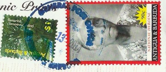
Sent by Ante from Antigua and Barbuda.

The Nelson's Dockyard was the former naval dockyard for the British Navy in the Leeward Islands of the Eastern Caribbean. It was established in English Harbour in the late 1720s and closed as a military installation in 1895. The narrow deep bays that comprises English Harbour are almost completely encloses by hills that provided the navy a safe, defensible harbour that was ideal for careening and repairing the wooden ships of war and for shelter during the hurricane season. This was a strategic advantage to the British as they were able to maintain a strong military presence in the Eastern Caribbean. With the loss of its North American colonists in 1776, the dockyard at English Harbour grew in importance as a station for repairs and provisions prior to the return voyage across the Atlantic to Britain; particularly so for battle damaged vessels. Naval tradition dictated that the senior naval officer at the dockyard assumed command and as a result many famous British naval heroes served in and commanded operations of the dockyard. These include, Admiral Lord Horatio Nelson, Admiral Vernon, Admiral Hood. Famous naval officers who visited the station include Admiral Collingwood, Prince William Henry (William IV), George V, and others.
The facility grew in capacity, size and importance over time. To protect it, a considerable investment was made by the British Army in building fortifications, hospitals, barracks, ordnance stores and infrastructure on the hills surrounding the Dockyard. Many regiments were sent to garrison the forts and it is said that about 40% did not make the return voyage, falling victim to the numerous tropical diseases including malaria, yellow fever, and dysentery. Most of these military facilities are today in ruin, but they provide abundant research opportunities for the archaeologists and museum curators. The Dockyard was finally abandoned as a British Naval outpost in 1889. For the next fifty years the old naval dockyard was used by Antiguan seamen and boat builders from the village of English Harbour as a careenage and repair facility for their wooden sloops and schooners that traded and provided inter island transportation. It was also used as a training facility for the West Indian soldiers prior to overseas service during both World Wars.
The site is now a protected area; the premiere National Park of Antigua that was established by the National Parks Act, 1984 and is managed as a heritage tourism site. (Source)


Antigua and Barbuda - Carlisle Bay Beach


Antigua, West Indies
One of Antigua's long and pretty white-sand beaches, the aquamarine blue waters of Carlisle Bay, lined with coconut palm trees and honeymoon umbrellas, make a romantic scene.

Sent by Ante from Antigua and Barbuda.


Antigua and Barbuda - 365 Beaches


Antigua, West Indies
The island that has 365 beautiful white-sand beaches, one for you to enjoy each day of the year.

Sent by Ante from Antigua and Barbuda.


United Arab Emirates - Abu Dhabi


UNITED ARAB EMIRATES
Abu Dhabi

Sent by Suzanne from Abu Dhabi, United Arab Emirates.

Abu Dhabi (/ˈɑːb ˈdɑːbi/; Arabic: أبو ظبي Abū Ẓabī Emirati pronunciation [ɐbuˈðˤɑbi]) is the capital and the second largest city of the United Arab Emirates in terms of population and the largest among the seven member emirates of the United Arab Emirates. Abu Dhabi lies on a T-shaped island jutting into the Persian Gulf from the central western coast. The city proper has a population of 921,000 in 2013.
Abu Dhabi houses offices of the federal government, and is the seat for the United Arab Emirates Government and the home for the Abu Dhabi Emiri Family and the President of the UAE from this family. Abu Dhabi has grown to be a cosmopolitan metropolis. Its rapid development and urbanisation, coupled with the relatively high average income of its population, has transformed Abu Dhabi to a larger and advanced metropolis. Today the city is the country's center of political, industrial activities, and a major cultural, and commercial centre due to its position as the capital. Abu Dhabi alone generated 56.7% of the GDP of the United Arab Emirates in 2008.
Abu Dhabi is home to important financial institutions such as the Abu Dhabi Securities Exchange, the Central Bank of the United Arab Emirates and the corporate headquarters of many companies and numerous multinational corporations. One of the world's largest producers of oil, Abu Dhabi has actively attempted to diversify its economy in recent years through investments in financial services and tourism.
Abu Dhabi is the second most expensive city for expatriate employees in the region, and 67th most expensive city in the world. Fortune magazine and CNN stated in 2007 that Abu Dhabi is the richest city in the world. (Source)


Tuesday, January 28, 2014

Antarctica/Australia/New Zealand - Macquarie Island


Say Ah? King penguin squawks at an elephant seal, Macquarie Island.

Sent by Vivienne from Christchurch, New Zealand.

Macquarie Island is an oceanic island in the Southern Ocean, lying 1,500 km south-east of Tasmania and approximately halfway between Australia and the Antarctic continent. The island is the exposed crest of the undersea Macquarie Ridge, raised to its present position where the Indo-Australian tectonic plate meets the Pacific plate. It is a site of major geo-conservation significance, being the only place where rocks from the Earth's mantle (6 km below the ocean floor) are being actively exposed above sea level.
It is the only island in the world composed entirely of oceanic crust and rocks from the Earth's mantle deep below the surface.
Macquarie Island probably began as a spreading ridge under the sea with the formation of new oceanic crust somewhere between 11 million and 30 million years ago.
At some stage the spreading halted and the crust began to compress, squeezing rocks upward from deep within the mantle. As the ridge grew it eventually became exposed above the ocean surface about 600,000 years ago. Thus, rocks normally only occurring deep within the Earth's mantle have become exposed on the surface.
Since Macquarie Island emerged, it has mainly been carved by marine processes such as wave action, unlike other subantarctic islands, which have been shaped by glaciers.
These unique exposures include excellent examples of pillow basalts and other extrusive rocks.
The main landscape feature is a central rolling plateau 250-300 m above sea level, bounded on all sides by steep cliffs, from the foot of which extends a coastal platform up to 800 m wide. Glacial drift up to 20 m thick covers much of the plateau and there are several lakes.
Among the most aesthetically appealing sights of the island are the vast congregations of wildlife, particularly penguins, on suitable parts of the coastal terrace, especially during breeding seasons.
During the breeding season on suitable beaches elephant seals also form impressive colonies. Four species of albatross nest on steep and rugged cliffs, both on the main island and on nearby Bishop and Clerk Islands.
The terrestrial area of Macquarie Island is a State Reserve with protection extending to low water mark. The marine values are protected by the Macquarie Island Marine Park declared by the Commonwealth on 28 October 1999. The primary purpose of the marine park is to protect the conservation values of the region from human disturbance. The marine park contains the world's largest marine highly protected zone, covering more than 16 million hectares.
Sealers discovered the island in 1810 and inhabited it periodically throughout the 19th century, exterminating the fur seals and greatly reducing the elephant seal population. In 1870, gangs came to exploit the king and royal penguin populations for oil, eliminating the former. The original elephant seal population of about 100,000 animals was reduced by 70% as a result of these operations. The visitors also brought exotic mammals and caused the extermination of two endemic subspecies of land birds.
There are no permanent human inhabitants on Macquarie Island although the Australian Antarctic Division station is occupied all year round. The only access to the island is by sea and there are no harbors or landing facilities, so ship-traffic in the area is minimal. (Source)


Note :-
Mail from the Ross Dependency is processed by the “Ross Dependency Agency”, located at a post office in Christchurch. Members of the public (mostly philatelists and stamp dealers) are able to post items bearing Ross Dependency stamps at this office.
Mail is canceled with the inscription “Ross Dependency Agency, Christchurch.

Kenya - Nairobi (1)


NAIROBI
Kenya's capital is a thriving cosmopolitan city and the commercial and communications centre of East Africa. Often called 'The Green City in the Sun' has wide tree-fined avenues and tall modern buildings, the skyline being dominated by the towering Kenyatta International Conference Centre, the city lies 5,500 feet above sea level and 160 kilometres South of the Equator.

Sent by Simon from Nairobi, Kenya.

Nairobi /nˈrbi/ is the capital and largest city of Kenya. The city and its surrounding area also form the Nairobi County. The name "Nairobi" comes from the Maasai phrase Enkare Nyrobi, which translates to "cold water". The phrase is also the Maasai name of the Nairobi river, which in turn lent its name to the city. However, it is popularly known as the "Green City in the Sun" and is surrounded by several expanding villa suburbs. Inhabitants of Nairobi are referred to as Nairobians, and the city is governed by the County Government of Nairobi, whose current governor is Evans Kidero.
Founded by the British in 1899 as a simple rail depot on the railway linking Mombasa to Uganda, the town quickly grew to become the capital of British East Africa in 1907, and eventually the capital of the newly independent Kenyan republic in 1963. During Kenya's colonial period, the city became a centre for the colony's coffee, tea and sisal industry. Nairobi city is also a county in itself. The city lies on the Nairobi River, in the south of the nation and has an elevation of 1795 m above sea-level.
Nairobi is the most populous city in East Africa, with a current estimated population of about 3 million. According to the 2009 Census, in the administrative area of Nairobi, 3,138,295 inhabitants lived within 696 km2 (269 sq mi). Nairobi is currently the 14th largest city in Africa, including the population of its suburbs. (read further)


Hong Kong - Chek Lap International Airport


HONG KONG
Chek Lap International Airport

Sent by Bryan from Hong Kong.

Hong Kong International Airport (IATA: HKGICAO: VHHH) is the main airport in Hong Kong. It is located on the island of Chek Lap Kok, which largely comprises land reclaimed for the construction of the airport itself. The airport is also colloquially known as Chek Lap Kok Airport (赤鱲角機場), to distinguish it from its predecessor, the closed Kai Tak Airport.
The airport has been commercially operational since 1998, replacing the former Kai Tak Airport, and is an important regional trans-shipment centre, passenger hub and gateway for destinations in Mainland China (with 44 destinations) and the rest of Asia. The airport is currently the world's busiest cargo gateway and one of the world's busiest passenger airports.
The Hong Kong International Airport is also home to one of the world's largest passenger terminal buildings (the largest when opened in 1998). Hong Kong International Airport is one of the busiest airports in Asia. It is operated by the Airport Authority Hong Kong, 24 hours a day, and is the primary hub for Cathay Pacific, Dragonair, Hong Kong Airlines, Hong Kong Express Airways and Air Hong Kong (cargo). The airport is one of the hubs of Oneworld alliance, and it is also one of the Asian-Pacific cargo hubs for UPS Airlines. It is a focus city for many airlines, including China Airlines and China Eastern AirlinesSingapore AirlinesEthiopian AirlinesVirgin Atlantic and Air India use Hong Kong as a stopover point for the flights respectively.
HKIA is an important contributor to Hong Kong's economy, with approximately 60,000 employees. More than 100 airlines operate flights from the airport to over 180 cities across the globe. In 2012 HKIA handled 56,557,751 passengers, making it the 12th busiest airport worldwide by passenger traffic. It also surpassed Memphis International Airport to become the world's busiest airport by cargo traffic.(read further)


Sunday, January 26, 2014

Guess The Country And Win A Postcard From Hard-To-Get Country


We are offering a postcard from really a hard-to-get country for one who guesses correctly the country/territory in which the above postcard was sent from.  

The postcard is still on its way to our mailbox.  Whether it reaches us or not, the one who guesses correctly will win this contest.

The deadline is when there is a winner or until Saturday, 25th January 2014, 23.59 p.m. (Malaysian time), whichever comes first.

Type your answer in the comment section.

The winner will be notified here.

We will publish the winner in the comment section.

Rules :-
1. You can only give one answer in a comment section. If you answer twice or more, only the first answer is counted.
2. ANONYMOUS can enter this contest at your own risk.
3. There will be only ONE winner.
4. Our friends who we promised to send you a postcard from this hard-to-get country are not eligible for this contest.

THE CLUE : The country/territory that we have not received yet.


Thursday, January 23, 2014

St. Lucia - Pitons Management Area

The village of Soufriere, the premiere heritage site in St. Lucia.
Sent by John Williams from Burnley, England.
Dominating the mountainous landscape of St Lucia are the Pitons, two steep-sided volcanic spires rising side by side from the sea. Gros Piton (770 m) is 3 km in diameter at its base, and Petit Piton (743 m) is 1 km in diameter and linked to the former by the Piton Mitan ridge.
The Pitons are part of a volcanic complex, known to geologists as the Soufriere Volcanic Centre which is the remnant of one (or more) huge collapsed stratovolcano. The volcanic complex overlies a tectonic plate subduction (underthrusting) zone which stretches 700 km along Lesser Antilles, forming a volcanic arc.
The Pitons are the eroded cores of two lava domes formed on the flanks of the stratovolcano. Today they tower above a caldera-like formation, produced by a gigantic gravity slide or structural collapse which formed the Qualibou Depression, 7 km in diameter. Near the centre of the depression are the Sulphur Springs, an active, high temperature geothermal field with sulphurous fumaroles and hot springs. The Pitons occur with a variety of other volcanic features including cumulo-domes, explosion craters, pyroclastic deposits (pumice and ash) and lava flows. Collectively, these fully illustrate the volcanic history of an andesitic composite volcano associated with crustal plate subduction.
The Marine Management Area is a coastal strip 11 km long and about 1 km wide. It comprises a steeply sloping continental shelf with fringing and patch reefs, boulders and sandy plains. The coral reefs, which cover almost 60% of the marine area, are healthy and diverse. A survey to a depth of 20 m revealed 168 species of finfish, 60 species of cnidaria, including corals, molluscs, sponges, echinoderms, arthropods and annelid worms. Hawksbill turtles are seen inshore, and whale sharks and pilot whales offshore.
The dominant terrestrial vegetation is tropical moist forest grading to subtropical wet forest with small areas of dry forest near the coast and on steep slopes, and areas of wet elfin woodland on the summits. On the Pitons especially, small undisturbed natural forests remain, preserved by the steepness of the land. At least 148 plant species have been recorded on Gros Piton and 97 on Petit Piton. Among these are several endemic or rare plants, including eight rare species of tree. Some bird species, including 5 endemics, are known from Gros Piton, along with indigenous rodents, opossum, bats, reptiles and amphibians.
The area is a multiple-use management where agriculture, artisan fishing, human settlement (1,500 residents) and tourism (four large hotel developments) are allowed. (Source)


Antigua and Barbuda - Galley Bay


Antigua, West Indies
Galley Bay

Sent by Ante from Antigua and Barbuda.


Italy - Veneto - Venice


VENEZIA
Punta della Dogana
Basilica Santa Maria della Salute

Sent by Raffaella from Italy.

Venice (English /ˈvɛnɪs/ItalianVenezia [veˈnɛttsia] alternative obsolete form: VinegiaVenetianVenexia [veˈnɛsja];LatinVenetiaSloveneBenetke) is a city in northeastern Italy sited on a group of 118 small islands separated by canals and linked by bridges. It is located in the marshy Venetian Lagoon which stretches along the shoreline, between the mouths of the Po and the Piave Rivers. Venice is renowned for the beauty of its setting, its architecture and its artworks. The city in its entirety is listed as a World Heritage Site, along with its lagoon. (read further)


Tuesday, January 21, 2014

Antarctica - The Antarctic Treaty


The Antarctic Treaty
The Treaty was negotiated by the 12 nations present in Antarctica during the International Geophysical Year (IGY) (1957-58).  It is a landmark agreement through which countries active in Antarctica consult on the uses of the whole continent.  The Treaty which applies to the area south of 60°S, is surprisingly short but remarkably effective.  Since entering into force on June 23, 1961, the Treaty has been recognized as one of the most successful international agreements ever negotiated.

The postcard is a SURPRISE, sent by someone from Amundsen-Scott South Pole Station in Antarctica. Thank you very much.


Mauritania - Ancient Ksour of Ouadane, Chinguetti, Tichitt and Oualata (2)


MAURITANIA
Mural decorations at Oualata.

Sent by Floyd of USA who went for a month-holiday in Mauritania. Thank you very much Floyd.

Oualata or Walata (Arabicولاته‎) (also Biru in 17th century chronicles) is a small oasis town in south east Mauritania that was important as a caravan city in the thirteenth and fourteenth centuries as the southern terminus of a trans-Saharan trade route. It is a World Heritage Site. (read further)


Mauritania - Assaba


MAURITANIA
Assaba (L'Assaba)

Sent by Floyd of USA who went for a month-long holiday in Mauritania.  Thank you very much Floyd.

Assaba (Arabicولاية العصابة‎) is a region in southern Mauritania. Its capital is Kifa. Other major cities/towns include Guerou. The region borders the Mauritanian regions of Brakna and Tagant to the north, the Mauritanian region of Hodh El Gharbi to the east, Malito the south, and the Mauritanian regions of Gorgol and Guidimaka to the west. (Source)


Italy - Puglia - Lecce


PUGLIA
Lecce
Piazza Duomo

Sent by Sergio from Lecce, Italy.