Monday, February 17, 2014

Italy - Tuscany - Historic Centre of Florence


Florence  (Firenze).

Sent by Cristine from Florence, Italy.

Starting in the 15th century, Florence exerted a powerful influence on the development of architecture and the monumental arts, first in Italy, and then throughout Europe. The historic centre attests in an exceptional manner, and by its unique coherence, to its power as a merchant-city of the Middle Ages and the Renaissance. Between the 14th and 17th centuries it was covered with prestigious buildings which illustrated the munificence of the bankers and princes.
Founded in 59 BC as a Roman colony known as Florentia, only in the 11th century did the free commune of Florence begin to succeed - both politically and economically - where other cities of Tuscany had failed, with the slow but unrestrainable process culminating in the annexation of Siena in 1557. In the 15th century, the city reached the apex of its splendour, thanks partly to the presence in Florence of such geniuses as the architects Filippo Brunelleschi and Leon Battista Alberti, the painters Masaccio, Paolo Uccello and Sandro Botticelli, and the sculptors Donatello, Lorenzo Ghiberti and Luca della Robbia, as well as the unforgettable Michelangelo Buonarotti and Leonardo da Vinci.
As early as the 15th century, the republican government was abolished and the Medici dynasty took over. Despite repeated attempts (all unsuccessful) to restore the republic, the Medicis ruled the Grand Duchy of Tuscany until it died out in 1737. Rule then passed to the Lorraine family, which remained in power until 1859 when Florence was annexed by the Kingdom of Italy. It was the political capital of Italy between 1865 and 1870, in addition to being the cultural capital.
Built over the Roman city, the historic centre of Florence may best be described as a treasure chest of works of art and architecture. Defined by the 14th-century walls, and built up thanks to the enormous business and economic power which Florence achieved, the two succeeding centuries were Florence's golden age. The spiritual focus of the city is the Cathedral Piazza of Santa Maria del Fiore, with Giotto's campanile on one side and the Baptistry of St John in front, with the Gates of Paradise by Lorenzo Ghiberti. Going north from here, one comes across the Palazzo Medici-Riccardi by Michelozzo and St Lawrence's Basilica by Brunelleschi with the sacristies inside designed by Donatello and Michelangelo. Further on are the Museum of St Mark's, with Fra Angelico's masterpieces, the Galleria dell'Accademia with Michelangelo'sDavid (1501-4) and the Santissima Annunziata Piazza with the Lodge of the Holy Innocents by Brunelleschi. On the south side of the cathedral is the political/cultural centre of Florence, with the Palazzo Vecchio and the Galleria degli Uffizi nearby. Close to these are the Museo del Bargello and the Basilica of the Holy Cross. Across the Ponte Vecchio is the Oltrarno quarter, with the Pitti Palace and Boboli Gardens. Still in the Oltrarno, mention must be made of the Holy Ghost Basilica by Filippo Brunelleschi and the Carmelite Church, with its frescoes by Masolino, Masaccio and Filippino Lippi. To the west of the cathedral are the imposing Strozzi Palace and the Basilica of Santa Maria Novella, its facade designed by Leon Battista Alberti.
The historic centre may be admirably viewed in its entirety from the surrounding hills, especially Piazzale Michelangelo (just under the Romanesque Basilica of San Miniato), or Fiesole, both of which offer some of the most spectacular views in the Arno valley. (Source)


Thursday, February 13, 2014

Western Sahara


Western Sahara

Sent by Damjan of Slovenia from the village of Aousserd (Moroccan-controlled region) in Western Sahara.  Thank you very much.

Chris (Damjan's colleague) who is operating a traveller's adventure company in Western Sahara wrote in an e-mail, "Officially there is no country called Western Sahara, even though many maps still show a border. Most of Western Sahara is occupied by Morocco since the late 1970s, so a postcard will only have a normal Moroccan stamp. The inland part of the country is called the Polisario Free Zone and there is a big sand wall ('berm') separating the two.  A regular traveller cannot visit the PFZ so easily and I think the Polisario use the postal service of Algeria or Mauritania to send letters".

Thanks to Chris too for your help.


Western Sahara (US /wɛstərn səˈhærə/, UK /ˌwɛstən səˈhɑrə/, Arabic: الصحراء الغربية Aṣ-Ṣaḥrā’ al-Gharbīyah, SpanishSahara Occidental, Berber: Taneẓroft Tutrimt) is a disputed territory in the Maghreb region of North Africa, bordered by Morocco to the north, Algeria to the extreme northeast, Mauritania to the east and south, and the Atlantic Ocean to the west. Its surface area amounts to 266,000 square kilometres (103,000 sq mi). It is one of the most sparsely populated territories in the world, mainly consisting of desert flatlands. The population is estimated at just over 500,000, of whom nearly 40% live in El Aaiún (also spelled Laâyoune), the largest city in Western Sahara.
Occupied by Spain since the late 19th century, the Western Sahara has been on the United Nations list of non-self-governing territories since 1963 after a Moroccan demand. It is the most populous territory on that list, and by far the largest in area. In 1965, the UN General Assembly adopted its first resolution on Western Sahara, asking Spain to decolonise the territory. One year later, a new resolution was passed by the General Assembly requesting that a referendum be held by Spain on self-determination. (read further)


Tuesday, February 11, 2014

French Guiana - Centre Spatial Guyanais


Cente Spatial Guyanais, Kourou, French Guiana.
1995-2012
Inaugural flights; Ariane 5 (1995), Soyouz (2011), and Vega (2012).

Sent by Eric of Centre Spatial Guyanais in Kourou, French Guiana.


The Guiana Space Centre or, more commonly, Centre spatial guyanais (CSG) is a French and European spaceport near Kourou in French Guiana. Operational since 1968, it is particularly suitable as a location for a spaceport as it fulfills the two major geographical requirements of such a site:
  • it is quite close to the equator, so that the spinning earth can impart some extra velocity to the rockets for free when launched eastward, and
  • it has uninhabited territory (in this case, open sea) to the east, so that lower stages of rockets and debris from launch failures cannot fall on human habitations.
The European Space Agency, the French space agency CNES, and the commercial Arianespace company conduct launches from Kourou. This is the spaceport used by the ESA to send supplies to the International Space Station using the Automated Transfer Vehicle.
The location was selected in 1964 to become the spaceport of France. When the European Space Agency (ESA) was founded in 1975, France offered to share Kourou with ESA. Commercial launches are bought also by non-European companies. ESA pays two thirds of the spaceport's annual budget and has also financed the upgrades made during the development of the Ariane launchers. (read further)


Friday, February 7, 2014

Macedonia - Mapcard


Macedonia.

Sent by Goran from Skopje, Macedonia.


Macedonia (Macedonian: Македонија, transliterated: Makedonija), officially the Republic of Macedonia (Република Македонија, transliterated: Republika Makedonija [rɛˈpublika makɛˈdɔnija]), is a country located in the central Balkan peninsula in Southeast Europe. It is one of the successor states of the former Yugoslavia, from which it declared independence in 1991. It became a member of the United Nations in 1993 but, as a result of a dispute with Greece over its name, it was admitted under the provisional reference of the former Yugoslav Republic of Macedonia (поранешна Југословенска Република Македонија, transliterated: Poranešna Jugoslovenska Republika Makedonija), sometimes abbreviated as FYROM.
A landlocked country, the Republic of Macedonia is bordered by Kosovo to the northwest, Serbia to the north, Bulgaria to the east, Greece to the south, and Albania to the west. It constitutes approximately the northwestern half of the larger geographical region of Macedonia, which also comprises parts of Greece and Bulgaria. The country's capital is Skopje, with 506,926 inhabitants according to the 2002 census. Other cities include Bitola, Kumanovo, Prilep, Tetovo, Ohrid, Veles, Štip, Kočani, Gostivar, Kavadarciand Strumica. It has more than 50 lakes and sixteen mountains higher than 2,000 m (6,562 ft). Macedonia is a member of the UN and the Council of Europe. Since December 2005 it has also been a candidate for joining the European Union and has applied for NATO membership. (read further)


Italy - Piedmont - Turin


Torino (Turin).

Sent by Raffaella from Turin, Italy.

Turin (Italian: Torino, pronounced [toˈriːno]; Piedmontese: Turin, pronounced [tyˈɾiŋ]; Latin: Augusta Taurinorum) is a city and an important business and cultural centre in northern Italy, capital of the Piedmont region, located mainly on the left bank of the Po River, in front of Susa Valley and surrounded by the western Alpine arch. The population of the city proper is 911,823 (December 2012) while the population of the urban area is estimated by Eurostat to be 1.7 million inhabitants. TheTurin metropolitan area is estimated by the OECD to have a population of 2.2 million.
The city has a rich culture and history, and is known for its numerous art galleries, restaurants, churches, palaces, opera houses, piazzas, parks, gardens, theatres, libraries, museums and other venues. Turin is well known for its baroque, rococo,neo-classical, and Art Nouveau architecture. Much of the city's public squares, castles, gardens and elegant palazzi such as Palazzo Madama, were built in the 16th and 18th century, after the capital of the Duchy of Savoy (later Kingdom of Sardinia) was moved to Turin from Chambery (nowadays France) as part of the urban expansion. (read further)


Thursday, February 6, 2014

Germany - Saxony - Dresden


Multiviews of Dresden.

Sent by Nadine from Dresden, Germany.

Dresden (German pronunciation: [ˈdʁeːsdən]; Upper Sorbian: Drježdźany) is the capital city of the Free State of Saxony in Germany. It is situated in a valley on the River Elbe, near the Czech border. The Dresden conurbation is part of the Saxon Triangle metropolitan area with 2.4 million inhabitants.
Dresden has a long history as the capital and royal residence for the Electors and Kings of Saxony, who for centuries furnished the city with cultural and artistic splendor. The city was known as the Jewel Box, because of its baroque andrococo city center. The controversial British and American bombing of Dresden in World War II towards the end of the war killed at least 25,000 civilians and destroyed the entire city center. The impact of the bombing ruined the face of the city, as did for other major German cities. After the war Restoration work has helped to reconstruct parts of the historic inner city, including the Katholische Hofkirche, the Semper Oper and the Dresdner Frauenkirche as well as the suburbs.
Before and since German reunification in 1990, Dresden was and is a cultural, educational, political and economic center of Germany and Europe. The Dresden University of Technology is one of the 10 largest universities in Germany and part of the German Universities Excellence Initiative. (read further)


Wednesday, February 5, 2014

Coca Cola Ad Card (5)


The ad says "help children from the neigborhood making a snowman".

Sent by Valia from Sofia, Bulgaria. Blagodarya vi mnogo.


Coca Cola Ad Card (4)


The ad says "surprise your friends with home-made Banitsa".

Sent by Valia from Sofia, Bulgaria.


Bulgaria - Rila Monastery


BULGARIA
Rila Monastery

Sent by Valia from Sofia, Bulgaria.

Rila Monastery was founded in the 10th century by St John of Rila, a hermit canonized by the Orthodox Church. His ascetic dwelling and tomb became a holy site and were transformed into a monastic complex which played an important role in the spiritual and social life of medieval Bulgaria. Destroyed by fire at the beginning of the 19th century, the complex was rebuilt between 1834 and 1862. A characteristic example of the Bulgarian Renaissance (18th–19th centuries), the monument symbolizes the awareness of a Slavic cultural identity following centuries of occupation. (read further)


Bulgaria - Sofia


BULGARIA
Sofia

Sent by Valia from Sofia, Bulgaria.

Sofia (Bulgarian: София, pronounced [ˈsɔfijɐ] is the capital and largest city of Bulgaria. Sofia is located at the foot of Mount Vitosha in the western part of the country. It occupies a strategic position at the centre of the Balkan Peninsula. Sofia's history spans 2,400 years. Its ancient name Serdica derives from the local Celtic tribe of the Serdi who established the town in the 5th century BC. It remained a relatively small settlement until 1879, when it was declared the capital of Bulgaria.
Sofia is the 15th largest city in the European Union with a population of around 1.3 million people, or 1,241,396 in the city proper. According to some unoffical sources there are 2 million living and working in Sofia. 
Sofia has been ranked by the Globalization and World Cities Research Network as a Beta− city. Many of the major universities, cultural institutions, and businesses of Bulgaria are concentrated in Sofia. (read further)


Norway - Oslo


NORWAY
Oslo
Slottet (Royal Palace) 

Sent by Signe from Oslo, Norway.

Oslo (English pronunciation: /ˈɒzl/, oz-loh, or, rarer [uslu] or [uʃlu]) is the capital of and most populous city in Norway. Oslo constitutes a county and a municipality.
Founded around 1000 AD, and established a "kaupstad" or trading place in 1048 by King Harald III, the city was elevated to abishopric in 1070 and a capital under Haakon V around 1300. Personal unions with Denmark from 1397 to 1523 and again from 1536 to 1814 and with Sweden from 1814 to 1905 reduced its influence. After being destroyed by a fire in 1624, the city was moved closer to Akershus Castle during the reign of King Christian IV and renamed Christiania in his honour. It was established as a municipality (formannskapsdistrikt) on 1 January 1838. Following a spelling reform, it was known as Kristiania from 1877 to 1925, when its original Norwegian name was restored.
Oslo is the economic and governmental centre of Norway. The city is also a hub of Norwegian trade, banking, industry and shipping. It is an important centre for maritime industries and maritime trade in Europe. The city is home to many companies within the maritime sector, some of which are among the world's largest shipping companies, shipbrokers and maritime insurance brokers. Oslo is a pilot city of the Council of Europe and the European Commission intercultural cities programme. (read further)


Tuesday, February 4, 2014

Antigua and Barbuda - Nelson's Dockyard


Antigua, West Indies
The columned ruins of Nelson's Dockyard overlook the tranquil waters of English Harbour, creating a scene of remarkable beauty.

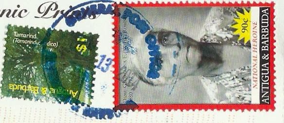
Sent by Ante from Antigua and Barbuda.

The Nelson's Dockyard was the former naval dockyard for the British Navy in the Leeward Islands of the Eastern Caribbean. It was established in English Harbour in the late 1720s and closed as a military installation in 1895. The narrow deep bays that comprises English Harbour are almost completely encloses by hills that provided the navy a safe, defensible harbour that was ideal for careening and repairing the wooden ships of war and for shelter during the hurricane season. This was a strategic advantage to the British as they were able to maintain a strong military presence in the Eastern Caribbean. With the loss of its North American colonists in 1776, the dockyard at English Harbour grew in importance as a station for repairs and provisions prior to the return voyage across the Atlantic to Britain; particularly so for battle damaged vessels. Naval tradition dictated that the senior naval officer at the dockyard assumed command and as a result many famous British naval heroes served in and commanded operations of the dockyard. These include, Admiral Lord Horatio Nelson, Admiral Vernon, Admiral Hood. Famous naval officers who visited the station include Admiral Collingwood, Prince William Henry (William IV), George V, and others.
The facility grew in capacity, size and importance over time. To protect it, a considerable investment was made by the British Army in building fortifications, hospitals, barracks, ordnance stores and infrastructure on the hills surrounding the Dockyard. Many regiments were sent to garrison the forts and it is said that about 40% did not make the return voyage, falling victim to the numerous tropical diseases including malaria, yellow fever, and dysentery. Most of these military facilities are today in ruin, but they provide abundant research opportunities for the archaeologists and museum curators. The Dockyard was finally abandoned as a British Naval outpost in 1889. For the next fifty years the old naval dockyard was used by Antiguan seamen and boat builders from the village of English Harbour as a careenage and repair facility for their wooden sloops and schooners that traded and provided inter island transportation. It was also used as a training facility for the West Indian soldiers prior to overseas service during both World Wars.
The site is now a protected area; the premiere National Park of Antigua that was established by the National Parks Act, 1984 and is managed as a heritage tourism site. (Source)


Antigua and Barbuda - Carlisle Bay Beach


Antigua, West Indies
One of Antigua's long and pretty white-sand beaches, the aquamarine blue waters of Carlisle Bay, lined with coconut palm trees and honeymoon umbrellas, make a romantic scene.

Sent by Ante from Antigua and Barbuda.


Antigua and Barbuda - 365 Beaches


Antigua, West Indies
The island that has 365 beautiful white-sand beaches, one for you to enjoy each day of the year.

Sent by Ante from Antigua and Barbuda.


United Arab Emirates - Abu Dhabi


UNITED ARAB EMIRATES
Abu Dhabi

Sent by Suzanne from Abu Dhabi, United Arab Emirates.

Abu Dhabi (/ˈɑːb ˈdɑːbi/; Arabic: أبو ظبي Abū Ẓabī Emirati pronunciation [ɐbuˈðˤɑbi]) is the capital and the second largest city of the United Arab Emirates in terms of population and the largest among the seven member emirates of the United Arab Emirates. Abu Dhabi lies on a T-shaped island jutting into the Persian Gulf from the central western coast. The city proper has a population of 921,000 in 2013.
Abu Dhabi houses offices of the federal government, and is the seat for the United Arab Emirates Government and the home for the Abu Dhabi Emiri Family and the President of the UAE from this family. Abu Dhabi has grown to be a cosmopolitan metropolis. Its rapid development and urbanisation, coupled with the relatively high average income of its population, has transformed Abu Dhabi to a larger and advanced metropolis. Today the city is the country's center of political, industrial activities, and a major cultural, and commercial centre due to its position as the capital. Abu Dhabi alone generated 56.7% of the GDP of the United Arab Emirates in 2008.
Abu Dhabi is home to important financial institutions such as the Abu Dhabi Securities Exchange, the Central Bank of the United Arab Emirates and the corporate headquarters of many companies and numerous multinational corporations. One of the world's largest producers of oil, Abu Dhabi has actively attempted to diversify its economy in recent years through investments in financial services and tourism.
Abu Dhabi is the second most expensive city for expatriate employees in the region, and 67th most expensive city in the world. Fortune magazine and CNN stated in 2007 that Abu Dhabi is the richest city in the world. (Source)


Tuesday, January 28, 2014

Antarctica/Australia/New Zealand - Macquarie Island


Say Ah? King penguin squawks at an elephant seal, Macquarie Island.

Sent by Vivienne from Christchurch, New Zealand.

Macquarie Island is an oceanic island in the Southern Ocean, lying 1,500 km south-east of Tasmania and approximately halfway between Australia and the Antarctic continent. The island is the exposed crest of the undersea Macquarie Ridge, raised to its present position where the Indo-Australian tectonic plate meets the Pacific plate. It is a site of major geo-conservation significance, being the only place where rocks from the Earth's mantle (6 km below the ocean floor) are being actively exposed above sea level.
It is the only island in the world composed entirely of oceanic crust and rocks from the Earth's mantle deep below the surface.
Macquarie Island probably began as a spreading ridge under the sea with the formation of new oceanic crust somewhere between 11 million and 30 million years ago.
At some stage the spreading halted and the crust began to compress, squeezing rocks upward from deep within the mantle. As the ridge grew it eventually became exposed above the ocean surface about 600,000 years ago. Thus, rocks normally only occurring deep within the Earth's mantle have become exposed on the surface.
Since Macquarie Island emerged, it has mainly been carved by marine processes such as wave action, unlike other subantarctic islands, which have been shaped by glaciers.
These unique exposures include excellent examples of pillow basalts and other extrusive rocks.
The main landscape feature is a central rolling plateau 250-300 m above sea level, bounded on all sides by steep cliffs, from the foot of which extends a coastal platform up to 800 m wide. Glacial drift up to 20 m thick covers much of the plateau and there are several lakes.
Among the most aesthetically appealing sights of the island are the vast congregations of wildlife, particularly penguins, on suitable parts of the coastal terrace, especially during breeding seasons.
During the breeding season on suitable beaches elephant seals also form impressive colonies. Four species of albatross nest on steep and rugged cliffs, both on the main island and on nearby Bishop and Clerk Islands.
The terrestrial area of Macquarie Island is a State Reserve with protection extending to low water mark. The marine values are protected by the Macquarie Island Marine Park declared by the Commonwealth on 28 October 1999. The primary purpose of the marine park is to protect the conservation values of the region from human disturbance. The marine park contains the world's largest marine highly protected zone, covering more than 16 million hectares.
Sealers discovered the island in 1810 and inhabited it periodically throughout the 19th century, exterminating the fur seals and greatly reducing the elephant seal population. In 1870, gangs came to exploit the king and royal penguin populations for oil, eliminating the former. The original elephant seal population of about 100,000 animals was reduced by 70% as a result of these operations. The visitors also brought exotic mammals and caused the extermination of two endemic subspecies of land birds.
There are no permanent human inhabitants on Macquarie Island although the Australian Antarctic Division station is occupied all year round. The only access to the island is by sea and there are no harbors or landing facilities, so ship-traffic in the area is minimal. (Source)


Note :-
Mail from the Ross Dependency is processed by the “Ross Dependency Agency”, located at a post office in Christchurch. Members of the public (mostly philatelists and stamp dealers) are able to post items bearing Ross Dependency stamps at this office.
Mail is canceled with the inscription “Ross Dependency Agency, Christchurch.