The Virgin Islands
Discovered by Columbus in 1493, they consist of about 60 sun-drenched islands and islets with near-perfect weather and unrivaled tropical scenery. The Virgin Islands are situated in the Caribbean Sea - 80 miles from Puerto Rico, 1000 miles from Miami and 1500 miles from New York.
Sent by
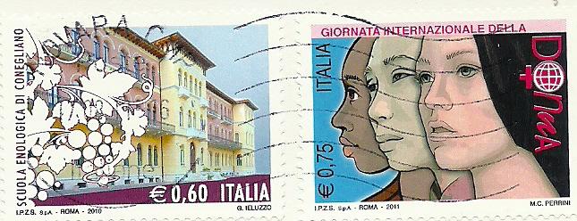
Nicole from St. Thomas in US Virgin Islands.
This is from Wikipedia :
The Virgin Islands of the United States (commonly called the
United States Virgin Islands or
U.S. Virgin Islands) are a group of islands in the Caribbean that are an insular area of the United States. The islands are geographically part of the Virgin Islands archipelago and are located in the Leeward Islands of the Lesser Antilles.
The U.S. Virgin Islands consist of the main islands of Saint Croix, Saint John, and Saint Thomas, along with the much smaller but historically distinct Water Island, and many other surrounding minor islands. The total land area of the territory is 133.73 square miles (346.4 km2).
As of the 2000 census the population was 108,612, mostly composed by those of Afro-Caribbean descent. Tourism is the primary economic activity, although there is a significant manufacturing sector.
Formerly the Danish West Indies, they were sold to the United States by Denmark in the Treaty of the Danish West Indies of 1916. They are classified by the UN as a Non-Self-Governing Territory, and are currently an organized, unincorporated United States territory. The Islands are organized under the Revised Organic Act of 1954, and have since held five constitutional conventions, the last proposed Constitution of 2009 being rejected by Congress in 2010.
The Virgin Islands were originally settled by the Ciboney, Carib, and Arawaks. The islands were named by Christopher Columbus on his second voyage in 1493 for Saint Ursula and her virgin followers. Over the next two hundred years, the islands were held by many European powers, including Spain, the United Kingdom, the Netherlands, France, and Denmark-Norway.
The Danish West India Company settled on Saint Thomas in 1672, on Saint John in 1694, and purchased Saint Croix from France in 1733. The islands became royal Danish colonies in 1754, named the Danish-Westindian islands (Danish: De dansk-vestindiske øer). Sugarcane, produced by slave labor, drove the islands' economy during the 18th and early 19th centuries, until the abolition of slavery by Governor Peter von Scholten on July 3, 1848.
For the remainder of the period of Danish rule, the islands were not economically viable and significant transfers were made from the Danish state budgets to the authorities in the islands. In 1867 a treaty to sell Saint Thomas and Saint John to the United States was agreed, but the sale was never effected. A number of reforms aimed at reviving the islands' economy were attempted, but none had great success. A second draft treaty to sell the islands to the United States was negotiated in 1902 but was narrowly defeated in the Danish parliament.
The onset of World War I brought the reforms to a close and again left the islands isolated and exposed. During the submarine warfare phases of the First World War, the United States, fearing that the islands might be seized by Germany as a submarine base, again approached Denmark with a view to buying them. After a few months of negotiations, a selling price of $25 million (This is equivalent to $428,000,000 in 2010 dollars) was agreed. At the same time the economics of continued possession weighed heavily on the minds of Danish decision makers, and a bipartisan consensus in favor of selling emerged in the Danish parliament.
The Treaty of the Danish West Indies was signed in August 1916, with a Danish referendum held in December 1916 to confirm the decision. The deal was finalized on January 17, 1917, when the United States and Denmark exchanged their respective treaty ratifications. The US took possession of the islands on March 31, 1917 and the territory was renamed the Virgin Islands of the United States. US citizenship was granted to the inhabitants of the islands in 1927.
Water Island, a small island to the south of Saint Thomas, was initially administered by the US federal government and did not become a part of the U.S. Virgin Islands territory until 1996, when 50 acres (200,000 m2) of land was transferred to the territorial government. The remaining 200 acres (81 ha) of the island were purchased from the U.S. Department of the Interior in May 2005 for $10, a transaction which marked the official change in jurisdiction.