Monday, February 20, 2012

South Korea - Gu Hye-seon/Ku Hye Sun


Gu Hye-seon in a scene of "Boys Over Flowers".

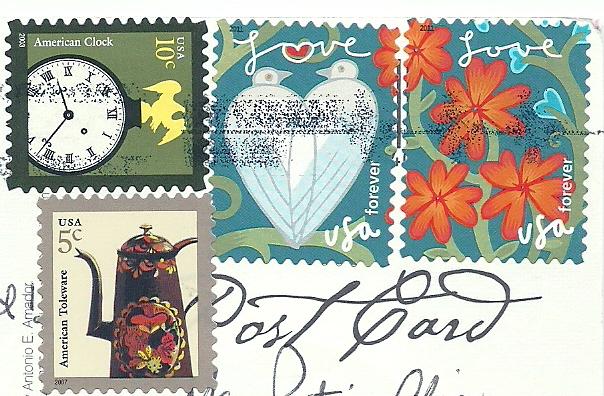
Sent by Yunjeong, a postcrosser from South Korea.

This is from Wikipedia : Ku Hye Sun (Korean: 구혜선, born November 9, 1984) is a South Korean actress, singer, author and director. An admirer of Leonardo Da Vinci, Ku also dabbles in directing, writing, illustrating, singing and composing. She is best known for her role as Geum Jan Di in the hit TV show Boys Over Flowers.

Ku entered the entertainment industry after gaining popularity on the internet as an ulzzang. She soon rose to fame in the drama Pure in Heart and surprised critics with her performance in the historical drama The King and I. Ku is most well known for portraying Geum Jan-di in the hit KBS drama Boys Over Flowers. After a year in limbo with no broadcasting slot, her pre-produced drama The Musical finally aired in September 2011. Ku will next star in the Taiwanese drama adaptation of the manga Absolute Boyfriend and is currently filming for the upcoming SBS series Take Care of Us, Captain.

Originally set to debut as a singer (supposedly in a 3-member girl group with 2NE1's Park Bom and Sandara Park), YG Entertainment CEO Yang Hyun-seok advised Ku to pursue acting rather than music. In recent years, she has displayed her vocal talents through Saranga (which became the title song of Pure in Heart), a cover of Shim Soo-bong's I Don't Know Anything But Love (which played during a crucial scene in Boys Over Flowers), and a duet of Kim Gun Mo's song Rain Falls on a Sleepless Night with Big Bang member Seungri on the music talk show Lee Hana's Peppermint. Ku has also composed an album of New Age music titled Breath.

Ku wrote Tango, a semi-autobiographical novel about a twenty-something woman's experience with love and relationships. The book was a bestseller, selling 30,000 copies within a week. Its release coincided with her first solo art exhibition, also titled Tango, in July 2009 at La Mer Gallery, which attracted 10,000 visitors. The exhibition featured around 40 of Ku's illustrations, some from her novel. She has also done artwork for Gummy's fourth album Comfort.

Ku made her official debut as a director through her short film The Madonna (Korean title translates to The Cheerful Caretaker) at the 2009 Puchon International Fantastic Film Festival. She has since written and directed her first feature-length film Magic, and her second film The Peach Tree premiered at the 2011 Busan International Film Festival.

In 2011 Ku established her own company, Ku Hye-sun Film, and she will produce and film her projects under its name, which will offer her a measure of legal/business protection.

Ukraine - Kiev


KYIV
1. The Dinamo Stadium.
2. A monument to V. Lobanovsky.
3. The view of Olympiysky Stadium.

Sent by Eugene, a postcrosser from Kiev, Ukraine.

Saturday, February 18, 2012

Russia - Russian UNESCO World Heritage Sites


Russian UNESCO World heritage Sites.,
Gefsimansky Skit, Sergiev Posad; Qol Sharif Mosque, Kazan; Church on Spilt Blood, St. Petersburg.
Saint Basil's Cathedral, Moscow; Dormition Cathedral, Vladimir; Kizhi Pogost, Kizhi Island.
Church of Christ's Ascension, Kolomenskoye; The Cathedral of the Annunciation, Kazan; The Kremlin, Moscow.

Sent by Tatiana, a postcrosser from Moscow, Russia.

United Kingdom - England - North Norfolk Mapcard


A mapcard showing interesting places in North Norfolk.

Sent by Audrey, a postcrosser from England.

This is from Wikipedia : North Norfolk is a local government district in Norfolk, United Kingdom. Its council is based in Cromer. The council headquarters can be found approximately 1 mile (1.6 km) out of the town of Cromer on the Holt Road.

The district was formed on 1 April 1974, under the Local Government Act 1972. It was a merger of Cromer Urban District, North Walsham Urban District, Sheringham Urban District, Wells-next-the-Sea Urban District, Erpingham Rural District, Smallburgh Rural District, and Walsingham Rural District.

The district was originally to be called Pastonacres, but changed its name by resolution of the council and permission of the Secretary of State for Environment before it formally came into existence on 1 April 1974.

Friday, February 17, 2012

Puerto Rico - Tropical Flowers


Tropical Flowers, Puerto Rico
From top left : Heliconia Hibiscus, Frangipani, Ginger (gengibre), Banana, Orchid (orquidea), Heliconia and Bromeliad.

Sent by Jare from Puerto Rico.

Ukraine - Lviv


Lviv - A multicultural city.

Sent by Daria, a postcrosser from Kiev, Ukraine.

This is from Wikipedia : Lviv (Ukrainian: Львів L’viv, IPA: [lʲwiu̯]; Polish: Lwów, pronounced [lvuf]; Russian: Львов, L'vov; German: Lemberg; Latin: Leopolis; see also other names) is a city in western Ukraine. The city is regarded as one of the main cultural centres of today's Ukraine and historically has also been a major Polish and Jewish cultural center, as Poles and Jews were the two main ethnicities of the city until the outbreak of World War II and the following Holocaust and Polish population transfers (1944–1946). The historical heart of Lviv with its old buildings and cobblestone roads has survived World War II and ensuing Soviet presence largely unscathed. The city has many industries and institutions of higher education such as the Lviv University and the Lviv Polytechnic. Lviv is also a home to many world-class cultural institutions, including a philharmonic orchestra and the famous Lviv Theatre of Opera and Ballet. The historic city centre is on the UNESCO World Heritage List. Lviv celebrated its 750th anniversary with a son et lumière in the city centre in September 2006.

Lviv was founded in 1256 in Red Ruthenia by King Danylo Halytskyi of the Ruthenian principality of Halych-Volhynia, and named in honour of his son, Lev. Together with the rest of Red Ruthenia, Lviv was captured by the Kingdom of Poland in 1349 during the reign of Polish king Casimir III the Great. Lviv belonged to the Crown of the Kingdom of Poland 1349–1772, the Austrian Empire 1772–1918 and the Second Polish Republic 1918–1939. With the Invasion of Poland at the outbreak of the second World War, the city of Lviv with adjacent land were annexed and incorporated into the Soviet Union, becoming part of the Ukrainian Soviet Socialist Republic from 1939 to 1941. Between July 1941 and July 1944 Lviv was under German occupation and was located in the General Government. In July 1944 it was captured by the Soviet Red Army and the Polish Home Army. According to the agreements of the Yalta Conference, Lviv was again integrated into the Ukrainian SSR. Most of the Poles living in Lviv were resettled into Polish territories annexed from Germany.

After the collapse of the Soviet Union in 1991, the city remained a part of the now independent Ukraine, for which it currently serves as the administrative centre of Lviv Oblast, and is designated as its own raion (district) within that oblast.

On 12 June 2009 the Ukrainian magazine Focus assessed Lviv as the best Ukrainian city to live in. Its more Western European flavor lends it the nickname the "Little Paris of Ukraine".

The city is expecting a sharp increase in the number of foreign visitors next summer for the 2012 UEFA European Football Championship, and as a result a major new airport terminal is being built. Lviv is one of 8 Polish and Ukrainian cities that is co-hosting the group stages of the tournament.

USA - California - Mapcard (2)


GREETINGS FROM CALIFORNIA
Nickname : The Golden State
Area in Square Miles : 158,297
Population : 36, 132,147
Entered in the Union : September 9th, 1856

Sent by BlueBat, a postcrosser from California, USA.

Finland - Petäjävesi Old Church


The Petäjävesi Evangelical Lutheran Old Church.

Sent by Terhi, a postcrosser from Helsinki, Finland.

This is from UNESCO : The Petäjävesi Evangelical Lutheran Old Church is a building of considerable global importance as an example of northern timber church architecture. The church is uniquely representative of log construction in the northern coniferous area and of the skills of the peasant population. European architectural trends have influenced the external form and the ground plan of the church, but they have been applied masterfully to traditional log construction. The church combines the layout of a Renaissance central church conception and older forms derived from Gothic groined ceilings. It reflects in an impressive way the architectural beauty of a northern rural Protestant church.

The church is situated on a peninsula where Lakes Jamsa and Petäjävesi meet. The location was determined by the fact that the congregation would be able to reach it by boat or over the ice in the winter. At the present time there is no settlement in the immediate vicinity of the church, since the town of Petäjävesi has developed about 1 km away.

Petäjävesi Old Church was designed and built in 1763-64 by a peasant master-builder, and in 1821 his grandson added the bell tower at the west end. Since a new church was built on the other side of the strait in 1879, the Old Church went out of use and was not maintained for many years, only the bell tower and cemetery being used for their original purpose. Repairs began in the 1920s when an Austrian art historian drew attention to its historical and architectural value.

The ground plan of the church is cruciform, the arms being virtually the same size. This form of church developed first in towns in the later 17th century, and only later spread into the countryside. The model was probably the stone church built in Stockholm in 1656 in a style derived from Italian architecture. The bell tower at the west end of the church is connected to it by a narrow corridor; the vestry is similarly linked with the eastern arm. The main structure is of horizontal log (Blockbau) construction, in the tradition to be found further to the east. The walls were not originally clad with planks, as at the present time. The four arms are covered by high, slightly angular vaults made from reddish pine planks, and there is an octagonal dome at the crossing. The circular design at the top of the dome derives from the classical opaion as interpreted in Renaissance architecture. The masking slats, base and tie-beams of the vaults are decorated in red ochre. The interior largely preserves its original form, as developed during the century (1764-1879) when it was in liturgical use. The distinctive features are the pulpit, pews, balustraded galleries and chandeliers, the elaborate carving of which is entirely the work of local craftsmen and artists.

The exterior is characterized by the steeply pitched roof, reminiscent of Gothic architecture. One of the doorways and the window of the choir have preserved their original triple arches. The lowest tier of the bell tower is in Blockbau construction, the walls and lantern being timber-framed with clapboard cladding. The bell trestle is supported on a sturdy log frame. Unlike the rest of the church, the bell tower is painted a different colour. The church is situated within a graveyard surrounded by a stone wall.

The period of neglect between 1879 and the 1920s was a blessing in disguise. When restoration began the historical importance of the building had been recognized and so interventions for restoration and conservation were kept to a minimum and used traditional techniques and materials. As a result the level of authenticity is exceptionally high.

Antique Maps


Antique Maps

Sent by J. Tills, a postcrosser from Wisconsin, USA. Terima kasih (thanks) for the beautiful stamps.

Thursday, February 16, 2012

Blue Tit (Cyanistes caeruleus)


Blue Tit (Cyanistes caeruleus)

Sent by Patricia, a postcrosser from Germany.

This is from Wikipedia : The Blue Tit (Cyanistes caeruleus or Parus caeruleus) is a small passerine bird in the tit family Paridae. The bird is easily recognisable by its blue and yellow plumage.

Blue tits, usually resident and non-migratory birds, are widespread and a common resident breeder throughout temperate and subarctic Europe and western Asia in deciduous or mixed woodlands with a high proportion of oak. They usually nest in tree holes, although they easily adapt to nest boxes where necessary. The main rivalry for nests and search for food is the much larger Great Tit.

The blue tit prefers insects and spiders for their diet. Outside the breeding season, they also eat seeds and other vegetable-based foods. Blue tits are famed for their skill, as they can cling to the outermost branches and hang upside down when looking for food.

This species was first described by Linnaeus in his Systema naturae in 1758 as Parus caeruleus.

Most authorities retain Cyanistes as a subgenus of Parus, but the British Ornithologists' Union treats Cyanistes as a distinct genus. This is supported by mtDNA cytochrome b sequence analysis which suggests that Cyanistes is not only distinct, but not close to other tits.

Bicycle (11)


Sent by Mary Lou & Greg, postcrossers from San Diego, USA.

Finland - Kemi


View of Kemi, Finland.

sent by Airi, a postcrosser from Kemi, Finland.

This is from Wikipedia : Kemi (Northern Sami: Giepma) is a town and municipality of Finland. It is located very near the city of Tornio. It was founded in 1869 by royal decree, because of its proximity to a deep water harbour.

Kemi is situated by the Bothnian Bay, at the mouth of river Kemijoki, and it is part of Lapland region. The town has a population of 22,579 (31 January 2011) and covers an area of 747.44 square kilometres (288.59 sq mi) of which 652.1 km2 (251.8 sq mi) is water. The population density is 236.83 inhabitants per square kilometre (613.4 /sq mi).

The main economic activity in Kemi is centred on two large paper and woodpulp mills and on the only chromium mine in Europe (which supplies the Outokumpu ferrochrome plant in Tornio). A polytechnic university is also situated in Kemi.

Kemi also has a claim to fame as the home of the world's largest snow castle (reconstructed every year with a different architecture). The snowcastle is usually located at the inner harbour of Kemi.

A model of The Crown of Finland (original was never made for the King of Finland) is kept in the Gemstone gallery. There are also replicas like the Imperial State Crown of Great Britain; the Sceptre of the Czar of Russia; Orbs of Denmark and the Diamond necklace of Marie Antoinette among other things.

It's also the hometown of the Power Metal band Sonata Arctica.

USA - Maryland - Mapcard


MARYLAND
Nickname : Old Line State
Are : 12,327 sq. miles
Entered into Union in 1788

Sent by Bob, a postcrosser from Washington D.C., USA.

Japan - "Ukiyoe"


"Ukiyoe" or "Ukiyo-e"

Sent by Yukari, a postcrosser from Japan.

This is from Wikipedia : Ukiyo-e (浮世絵, literally "pictures of the floating world"?) (Japanese pronunciation: [ukijo.e] or [ukijoꜜe]) is a genre of Japanese woodblock prints (or woodcuts) and paintings produced between the 17th and the 20th centuries, featuring motifs of landscapes, tales from history, the theatre, and pleasure quarters. It is the main artistic genre of woodblock printing in Japan.

Usually the word ukiyo is literally translated as "floating world" in English, referring to a conception of an evanescent world, impermanent, fleeting beauty and a realm of entertainments (kabuki, courtesans, geisha) divorced from the responsibilities of the mundane, everyday world; "pictures of the floating world", i.e. ukiyo-e, are considered a genre unto themselves.

The contemporary novelist Asai Ryōi, in his Ukiyo monogatari (浮世物語, "Tales of the Floating World", c. 1661?), provides some insight into the concept of the floating world:

... Living only for the moment, turning our full attention to the pleasures of the moon, the snow, the cherry blossoms and the maple leaves; singing songs, drinking wine, diverting ourselves in just floating, floating; ... refusing to be disheartened, like a gourd floating along with the river current: this is what we call the floating world...

The art form rose to great popularity in the metropolitan culture of Edo (Tokyo) during the second half of the 17th century, originating with the single-color works of Hishikawa Moronobu in the 1670s. At first, only India ink was used, then some prints were manually colored with a brush, but in the 18th century Suzuki Harunobu developed the technique of polychrome printing to produce nishiki-e.

Ukiyo-e were affordable because they could be mass-produced. They were mainly meant for townsmen, who were generally not wealthy enough to afford an original painting. The original subject of ukiyo-e was city life, in particular activities and scenes from the entertainment district. Beautiful courtesans, bulky sumo wrestlers and popular actors would be portrayed while engaged in appealing activities. Later on landscapes also became popular. Political subjects, and individuals above the lowest strata of society (courtesans, wrestlers and actors) were not sanctioned in these prints and very rarely appeared. Sex was not a sanctioned subject either, but continually appeared in ukiyo-e prints. Artists and publishers were sometimes punished for creating these sexually explicit shunga.

Vietnam - Mekong Delta - Bicycle-Pulled


Bicycle-pulled - a popular vehicle in the Mekong Delta.

Sent by Lyra, a postcrosser from Vietnam.

Spain - Map of Spain


Map of Spain.

Sent by Belem, a postcrosser from Spain,

Wednesday, February 15, 2012

Monday, February 13, 2012

Brazil - University of São Paulo - Campus de Pirassununga


An aerial view of Pirassununga Campus of University of São Paulo.

Sent by Constança, a postcrosser from São Paulo, Brazil.

This is from Wikipedia : Universidade de São Paulo (University of São Paulo, short USP) is a public university in the Brazilian state of São Paulo. It is the largest Brazilian university and one of the country's most prestigious. According to reports by the Ministry of Science and Technology, more than 25% of the articles published by Brazilian researchers in high quality conferences and journals are produced at the University of São Paulo.

USP is one of the largest institutions of higher education in Latin America, with approximately 90,000 enrolled students. It has eleven campuses, four of them in São Paulo (the main campus is called Campus Armando de Salles Oliveira, with an area of 7,443,770 m²). The other campi are in the cities of Bauru, Lorena, Piracicaba, Pirassununga, Ribeirão Preto and two in São Carlos. USP is involved in teaching, research and university extension in all areas of knowledge.

In 1934, during a period known for the "search for alternatives", along with political centralisation, efforts were carried out to provide Brazil with modern administrative, educational and military institutions. One of the main initiatives included the creation, that same year, of the University of São Paulo. Its nucleus was the Faculty of Philosophy, Sciences and Languages, with professors coming from France, Italy, Spain, Germany and other European countries.

USP also brought together several research and higher-education institutions that already existed in Brazil such as the Faculty of Medicine (Faculdade de Medicina), the Polytechnic School (Escola Politécnica), "Luiz de Queiroz" College of Agriculture (Escola Superior de Agricultura Luiz de Queiroz),and the College of Law (Faculdade de Direito).

According to the 2010 Academic Ranking of World Universities, USP is placed in the group of the 101-151 top world universities. In the 2011 QS World University Rankings University of Sao Paulo ranked 169th and is the best classified in the specific ranking of South America's universities. In 2011, the University of Sao Paulo is the first Ibero-American institution in the Times Higher Education World University Rankings's top-200 (Position 178 in the World).

Indonesia - Dani Tribe


Dani tribe's youngsters wearing 'Sali', traditional outfits with beads made of seashells.

Sent by Juned, a postcrosser from Bogor, Indonesia.

This is from Wikipedia : The Dani people, also spelled Ndani, and sometimes conflated with the Lani group to the west, are a people from the central highlands of western New Guinea (the Indonesian province of Papua).

They are one of the most populous tribes in the highlands, and are found spread out through the highlands. The Dani are one of the most well-known ethnic groups in Papua, due to the small numbers of tourists who visit the Baliem Valley area where they predominate. "Ndani" is the name given to the Baliem Valley people by the Moni people, and, while they don't call themselves Dani, they have been known as such since the 1926 Smithsonian Institution-Dutch Colonial Government expedition to New Guinea under Matthew Stirling who visited the Moni.

A small fringe group of the Dani, living south of Puncak Trikora and presenting themselves as the Pesegem and the Horip tribes, were met on October 29, 1909, by the Second South New Guinea Expedition led by Hendrikus Albertus Lorentz, who stayed several nights in their village. First contact with the populous Western Dani was made in October 1920 during the Central New Guinea Expedition, which group of explorers stayed for six weeks with them at their farms in the upper Swart River Valley (now Toli Valley). The Grand Valley Dani were only sighted in the summer of 1938 from an airplane by Richard Archbold.

Sweet potatoes are important in their local culture, being the most important tool used in bartering, especially in dowries. Likewise pigs feasts are extremely important to celebrate events communally; the success of a feast, and that of a village "Big Man" (man of influence) or organiser, is often gauged by the number of pigs slaughtered.

The Dani use an earth oven method of cooking pig and their staple crops such as sweet potato, banana, and cassava. They heat some stones in a fire until they are extremely hot, then wrap cuts of meat and pieces of sweet potato or banana inside banana leaves. The food package is then lowered into a pit which has been lined with some of the hot stones described above, the remaining hot stones are then placed on top, and the pit is covered in grass and a cover to keep steam in. After a couple of hours pit is opened and the food removed and eaten. Pigs are too valuable to be served regularly, and are reserved for special occasions only.

Ritual small-scale warfare between rival villages is integral to traditional Dani culture, with much time spent preparing weapons, engaging in both mock and real battle, and treating any resulting injuries. Typically the emphasis in battle is to insult the enemy and wound or kill token victims, as opposed to capturing territory or property or vanquishing the enemy village. The Dani practiced cannibalism well into the 20th century, as documented by missionaries who were invited to witness tribe members dismembering the body of an enemy slain in battle the day before as the fallen warrior's kin watched from a nearby hilltop.

Changes in the Dani way of life over the past half century are tied to the encroachment of modernity and globalization, despite tourist brochures describing trekking in the highlands with people from the 'stone age'. Observers have noted that pro-independence and anti-Indonesian sentiment tends to run higher in highland areas than for other areas of Papua. There are cases of abuses where Dani and other Papuans have been shot and/or imprisoned trying to raise the flag of West Papua, the Morning Star.


Poland - Będzin


Views of interesting places in Będzin, Poland.

Sent by Ewa from Będzin, Poland.

This is from Wikipedia : Będzin [ˈbɛnd​͡ʑin] (also Bendzin, Yiddish: Bendin בענדין, German: Bendzin, Bendsburg) is a city in Zagłębie Dąbrowskie in southern Poland. Located in the Silesian Highlands, on the Czarna Przemsza river (tributary of the Vistula), the city borders the Upper Silesian Metropolitan Union - a metro area with a population of about 2 million.

It has been situated in the Silesian Voivodeship since its formation in 1999. Before 1999, it was located in Katowice Voivodeship. Będzin is one of the cities of the 2.7 million person conurbation - Katowice urban area and within a greater Silesian metropolitan area populated by about 5,294,000 people. The population of the city is 58,639 (2008).

According to archeological finds, the settlement has existed since the early Middle Ages. The earliest historical mention of Będzin comes from 1301, when it is listed as a village. It was granted Magdeburg rights and became a city in 1358.

Until World War II, Będzin had a vibrant Jewish community. According to the Russian census of 1897, out of the total population of 21,200, Jews constituted 10,800 (around 51% percent). According to the 1921 census the town had a Jewish community consisting of 17,298 people, or 62.1 percent of its total population. In September 1939, the German Army (Wehrmacht) overran this area, followed by the SS death squads (Einsatzgruppen), who burned the Będzin synagogue and murdered many of the Jewish inhabitants. A Będzin Ghetto was created in 1942. Eventually, in the summer of 1943, most of the Jews in Będzin were deported to the nearby German concentration camp at Auschwitz. Since Będzin was one of the last Polish communities to be liquidated, there are a relatively large number of survivors from there, and an extensive collection of their personal photographs were recovered, offering photographic insight into the pre-war life there.

USA - New York


NEW YORK
From the United Nations Looking Downtown.

Sent by Oleg, a postcrosser from New York, USA. Terima kasih (thanks) for the nice beautiful big UN stamps.

Friday, February 10, 2012

Peru - Market in Pisac-Cusco


Pisac-Cusco, Peru
"Don't bargain honey, I can't come down, how much do you think I make on these onions?"

Sent by Tanya from Lima, Peru.

Peru - Puya de Raymondi


Puya de Raymondi or Puya Raimondii.

Sent by Tanya from Lima, Peru.

This is from Wikipedia : Puya raimondii, also known as Queen of the Andes, is an endemic species of Bolivia and Peru, and whose distribution is restricted to the high Andes at an elevation of 3200 – 4800 m. It was the French scientist Alcide d'Orbigny (1802–1857) who was the first non-native person to discover it in 1830, in the region of Vacas, Cochabamba Department, in Bolivia at an altitude of 3960 m (12,992 ft). The name of Puya raimondii commemorates the Italian scientist Antonio Raimondi (1826–1890), who resided in Peru for many years and made wide botanical explorations there. He discovered this species later in Peru in the region of Chavín de Huantar and published it as Pourretia gigantea in El Perú, Volume 1, Page 297 . In 1928, the name was changed to Puya raimondii by the German botanist Hermann Harms.

This plant has a gigantic inflorescence that may reach up to 10 m height, with more than three thousand flowers and six million seeds in each plant. Its reproductive cycle is approximately 40 years.

One planted near sea level at the University of California Botanical Garden, USA, in 1958 grew to 7,6 m (24 ft 11) in and bloomed as early as August 1986 after only 28 years. It is not only the largest of the Puya species, but also the largest Bromeliad. It can reach 3 m tall in vegetative growth, with a flower spike 9–10 m tall. Like most Bromeliads, it dies soon after flowering. It is considered to be an endangered species. Seeds were collected of P. raimondii in 1999 and 2000 of the rodales of Huashta Cruz (district Pueblo Libre, Ancash region, Peru), near the city of Caraz. It is also known to grow in the Masma Chicche District of Jauja Province.

Only 45 km West from Caraz (Ancash - Peru) at 4200m above sea level, at Huashta Cruz, on the Cordillera Negra, there is a "rodal" of puyas, with an impressive 145 km view of the Cordillera Blanca. The place it's known as "Huinchus" as the presence of the (Patagona Gigas) giant colibri, it's often spotted here. In the area of Catac in Peru there are lots of the famous Puyas Raimondi. On August 10, 2009, these plants were clearly shown signs of an imminent blooming stage. These plants are mainly located in the spacious forests from three important places of Ancash: the gully of Ingenio in Catac, the punas of Cajamarquilla and the gully of Queshque, also in Catac.

In Bolivia - apart from Vacas Municipality where these plants are spread on an area of about 1 km² - the only other place to find Puya raimondii is Comanche mountain in Caquiaviri Canton, Caquiaviri Municipality, Pacajes Province, La Paz Department.

Chile - Circuito Cultural Transantiago


What is it? It's a special Transantiago bus loop tour that will take you to the main attractions of the city including museums, cultural centres, typical areas an heritage buildings. The bus circuit operates on Sundays and holidays between 10:00AM and 6:30PM.
How can I use it? You can get on Cicuito Cultural in the circuit bus stops marking your Bip! Card* only once, a courier will give you a bracelet that will allow you to board the buses of the circuit as many times as you like and to continue visiting other places of your interest.

Sent by my best friend Hernán from Santiago, Chile.

This is from Wikipedia : Transantiago is a public transport system that serves Santiago, the capital of Chile. It is considered the most ambitious transport reform undertaken by a developing country according to the World Resources Institute.

The system was introduced on February 10, 2007. It standardized bus routes and eliminated redundancy of same; redundancies were commonplace in the old system, which was run by thousands of independent bus operators. The system combines local (feeder) bus lines, main bus lines and the Metro (subway) network. It includes an integrated fare system, which allows passengers to make bus-to-bus or bus-to-metro transfers for the price of one ticket, using a single contactless smart card.

Transantiago's implementation was problematic, as the decreased bus fleet and the newer routes have proved insufficient to properly serve a population inadequately informed of pending changes. The major complaints are the lack of buses and their inconsistent frequencies, missing or poor infrastructure (such as segregated corridors, prepaid areas and bus stops), the network's coverage, and the number of transfers needed for longer trips. As a result, users have overcrowded the Metro, which is generally held to be fast and dependable.

Transantiago's first stage of implementation began on October 22, 2005, when a group of ten new companies took control of the capital's bus system, immediately introducing 1,181 new, modern low-floor buses (approximately half of them being articulated) made by Volvo in Brazil, replacing 461 yellow-colored buses from the old system. The new buses will temporarily run alongside the over 7,000 existing older buses that will be gradually removed from the system until 2010. In October 2006, a users' information system was introduced.

Transantiago became fully operational on February 10, 2007 with the introduction of a new route system dividing bus lines into two complementary groups: main and local lines. In addition, a new fare structure was implemented, allowing transfers at small or zero fares between buses and metro, when using the new contactless smartcard. 1,776 new buses will operate at this stage. The older yellow-colored (now painted over) buses will only operate through the secondary local lines in conjunction with new but simpler buses. It is expected that by 2010, the older buses will be completely replaced by over 4,600 new vehicles.