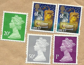
This is a project of collecting postcards from all over the world.
Wednesday, December 14, 2011
Netherlands - Klederdracht Zeeland
Klederdracht Zeeland : (1) Arnemuiden (2) Arnemuiden (Visser) (3)+(4) Cadzand (5) Nieuw en St. Joosland (6)+(7) Walcheren (8)+(9) Prot. Zuit Beveland.
Sent by Marjan, a postcrosser from Netherlands.
Belgium - La Grand-Place, Brussels (2)
Tuesday, December 13, 2011
Switzerland - Swiss Alps Jungfrau-Aletsch
Swiss Alps Jungfrau-Aletsch.
Sent by Katharina, a postcrosser from Switzerland.
This is from UNESCO : The Jungfrau-Aletsch-Bietschhorn region is located in the south central Swiss Alps midway between the cities of Brig and Interlaken, 77% in Valais and 23% in Bern. Nine peaks in the site are higher than 4,000 m.
The geology of the site derives from the 'Helvetic nappe' (a large body of rock that was thrust over younger rock in Europe during the Miocene epoch). The folding and over-thrusting of rock layers during the formation of the Alps have produced very complex rock formations that have since been exposed by glacial activity. The physiography of the area is characterized by steep north-facing slopes and relatively gentle southern ones. Classic examples of glacial phenomena occur in the site, such as U-shaped valleys, valley glaciers, cirques, horn peaks and moraines.
Vegetation and fauna are representative of the Alps and vary by slope, aspect and elevation. There is a marked difference in vegetation between the northern and southern slopes. On the north side, forests at lower elevations consist of broadleaved species such as beech, ash, alder, elm and birch. The south side is too dry for beech, which is replaced by Scots pine. On the northern side, the subalpine zone is dominated by Norway spruce with mountain ash, silver birch and stone pine and, on the southern side, by more continental species such as European larch on young soils.
Above the timberline are extensive areas of rhododendron scrub, alpine grassland and tundra vegetation and, on the xeric southern slopes, steppe grassland.
Fauna in the region is typical of the Alps, with a wide variety of species including ibex, lynx, red deer, roe deer, chamois and marmot as well as several reptiles and amphibians. A representative range of alpine birds also occurs, including golden eagle, kestrel, chough, ptarmigan, black grouse, snow finch, wallcreeper, lammergeier, pygmy owl and various woodpecker species.
The Jungfrau-Aletsch-Bietschhorn stands out in having the following four qualities:
* The scenic and aesthetic appeal is one of the most dramatic in the Alps, as evidenced by the long history of international visitation. The impressive northern wall of the site with the panorama of the Eiger, Mönch and Jungfrau mountains provides a classic view of the north face of the High Alps. The only other alpine regions that rival it for sheer scenic splendour are the Pennine Alps around the Matterhorn/Monte Rosa and Mont Blanc.
* Glaciation is the most extensive in the Alps. The Aletsch is the largest and longest glacier in western Eurasia in terms of area (128km2), length (23km) and depth (900m).
* The extensive glaciation and rugged topography, as well as protection measures dating back to 1933, have resulted in this being one of the most (if not the most) undisturbed natural areas in the Alps.
* For its record of productive scientific research on geology, geomorphology, climatic change, biology and atmospheric physics, the region is unsurpassed in the Alps and, in certain fields, at the global level. Observations on some of the glaciers go back to the 12th century and have allowed reconstructions of historical fluctuations.
Frank Vincent Zappa (2)
Germany - The Wadden Sea
The Wadden Sea.
Sent by Norbert, a postcrosser from Germany.
This is from UNESCO : The Wadden Sea comprises the Dutch Wadden Sea Conservation Area and the German Wadden Sea National Parks of Lower Saxony and Schleswig-Holstein. It is a large temperate, relatively flat coastal wetland environment, formed by the intricate interactions between physical and biological factors that have given rise to a multitude of transitional habitats with tidal channels, sandy shoals, sea-grass meadows, mussel beds, sandbars, mudflats, salt marshes, estuaries, beaches and dunes. The inscribed site represents over 66% of the whole Wadden Sea and is home to numerous plant and animal species, including marine mammals such as the harbour seal, grey seal and harbour porpoise. It is also a breeding and wintering area for up to 12 millions birds per annum and it supports more than 10 percent of 29 species. The site is one of the last remaining natural, large-scale, intertidal ecosystems where natural processes continue to function largely undisturbed.
Sunday, December 11, 2011
Ukraine - "Kraina Mriy"
Ukrainian world music festival "Kraina Mriy" 1.
Sent by Iryna, a postcrosser from Kiev, Ukraine.
"Ukrainian world music festival "Kraina Mriy" is the international musical folk-lore action which passes every year since 2004 in Kiev (Ukraine) during a few days on celebration of Ivana Kupala (Bathed Ivan) – traditional Ukrainian sainting of solstice in a summer pore at the end of june – beginning july.
The main idea of festival consists in a revival of the traditional Ukrainian culture, support of modern musical ethnic styles, acquaintance of the Ukrainian spectator with the elements of ethnos of different people.
Initiator, the founder and artistic director of the festival is Oleg Skrypka, the leader of the legendary Ukrainian rock band Vopli Vidopliassova (www.vopli.com.ua). The title song written by a band ("Kraina Mriy" – "Land Of Dreams") gave the name of international ethnic festival.
Action takes a place as a folk walking fair and consists of Folk-lore stages, Kobza players stage, Workshop of folk dances, Child’s meadow, Alley of Masters, Cossack entertainments, Exhibition of folk painting, Book’s fair, Ethnic kitchens, Literary stage, Evening stage."(Source)
USA - New York - Albany
ALBANY, NEW YORK
A bird's-eye view of the city with the many contemporary structures mingling with the historic architecture. Located in the background is the Hudson River.
Sent by Cathy, a WiP partner from New York, USA.
This is from Wikipedia : Albany (i/ˈɔːlbəniː/ awl-bə-nee) is the capital city of the U.S. state of New York, the seat of Albany County, and the central city of New York's Capital District. Roughly 150 miles (240 km) north of New York City, Albany sits on the west bank of the Hudson River, about 10 miles (16 km) south of its confluence with the Mohawk River. The population of the city was 97,856 at the time of the 2010 census, and the population of the greater metropolitan area was estimated at 857,592 in 2009. Albany has close ties with the nearby cities of Troy, Schenectady, and Saratoga Springs, forming a region called the Capital District. The bulk of this area is made up of the Albany-Schenectady-Troy Metropolitan Statistical Area (MSA); this MSA is the fourth-largest urban area in New York and the 56th-largest MSA in the country.
Albany saw its first European settlement in 1614 and was officially chartered as a city in 1686. It became the capital of New York in 1797. It is one of the oldest surviving settlements from the original thirteen colonies, and the longest continuously chartered city in the United States. Modern Albany was founded as the Dutch trading posts of Fort Nassau in 1614 and Fort Orange in 1624; the fur trade brought in a population that settled around Fort Orange and founded a village called Beverwijck. The English took over and renamed the city Albany in 1664, in honor of the then Duke of Albany, the future James II of England and James VII of Scotland. The city was officially chartered in 1686 with the issuance of the Dongan Charter, the oldest effective city charter in the nation and possibly the longest-running instrument of municipal government in the Western Hemisphere. Albany is one of the first cities in the world to install public water mains and sewer lines. It is also one of the first cities in the world to install natural gas lines and electricity. This technology in Albany brought substantial new industry into the city and surrounding areas during the 19th century. During the late 18th century and throughout most of the 19th, Albany was a center of transportation. It is located on the north end of the navigable Hudson River, was the original eastern terminus of the Erie Canal, and was home to some of the earliest railroad systems in the world. Albany's main exports at the time were beer, lumber, published works, and ironworks. Beginning in 1810, Albany was one of the ten most populous cities in the nation, a distinction that it held until the 1860 census. In the 20th century, the city opened one of the first commercial airports in the world, the precursor of today's Albany International Airport. The 1920s saw the rise of a powerful political machine controlled by the Democratic Party. The city's skyline changed in the 1960s with the construction of the Empire State Plaza and the uptown campus of SUNY Albany, mainly under the direction of Governor Nelson Rockefeller. While Albany experienced a decline in its population due to urban sprawl, many of its historic neighborhoods were saved from destruction through the policies of Mayor Erastus Corning 2nd, the longest-serving mayor of any city in the United States. More recently, the city has experienced growth in the high-technology industry, with great strides in the nanotechnology sector.
Albany has been a center of higher education for over a century, with much of the remainder of its economy dependent on state government and health care services. The city has experienced a rebound from the urban decline of the 1970s and 1980s, with noticeable development happening in the city's downtown and midtown neighborhoods. Albany is known for its extensive history, culture, architecture, and institutions of higher education. The city is home to the mother churches of two Christian dioceses as well as the oldest Christian congregation in Upstate New York. Albany has won the All-America City Award in both 1991 and 2009.
Russia - Sochi 2014 Winter Olympics
Sochi 2014 Winter Olympics.
Sent by Julia, a postcrosser from Tomsk, Russia.
This is from Wikipedia : The 2014 Winter Olympics, officially the XXII Olympic Winter Games, or the 22nd Winter Olympics, is a major international multi-sport event scheduled to be celebrated from 7 to 23 February 2014, in Sochi, Russia with some events held in the resort town of Krasnaya Polyana. Both the Olympic and Paralympic Games are being organized by the Sochi Organizing Committee (SOOC). The 2014 Winter Olympics will become the second Olympics hosted by Russia. Previously, Russia hosted the 1980 Summer Olympics in Moscow. These are the first Olympics (and first Winter Olympics altogether) for the Russian Federation however, as the 1980 Summer Olympics were in the former Soviet Union.
Following Olympic tradition, Sochi mayor Anatoliy Pakhomov received the Olympic flag during the closing ceremony of the 2010 Winter Olympics in Vancouver, Canada.
The city was elected on 4 July 2007, during the 119th International Olympic Committee (IOC) Session in Guatemala City, Guatemala. This will be the first time that the Russian Federation will host the Winter Olympics; the Soviet Union hosted the 1980 Summer Games in Moscow.
Saturday, December 10, 2011
Japan - Sirakawa-Go - Gasshō-zukuri
"Gasshō-zukuri" houses in Sirakawa-Go, a UNESCO World Heritage Site.
Sent by Masayo, a postcrosser from Tokyo, Japan.
This is from UNESCO : The historic villages of Shirakawa-go and Gokayama are outstanding examples of traditional human settlements that are perfectly adapted to their environment and their social and economic raison d'être and have adjusted successfully to the profound economic changes in Japan in the past half-century.
In the 8th century AD this area was opened up as a place for ascetic religious mountain worship, centred on Mount Hakusan, for an order that combined ancient pre-Buddhist beliefs with esoteric Buddhism. In the 13th century it came under the influence of the Tendai Esoteric sect, and then by the Jodo Shinshu sect, which is still influential in the area. Its teachings played an important role in the development of the social structure of the region, based on the kumi system of mutual cooperation between neighbouring households.
Shirakawa-go was part of the territory of the Takayama Clan at the beginning of the Edo period, but from the late 17th century until the Meiji Restoration of 1868 it was under the direct control of the Edo Bakufu (military government). Gokayama was under direct rule by the Kanazawa Clan throughout the Edo period.
Because of the mountainous terrain, traditional rice-field production was not wholly successful in the area, and so the farmers turned to alternative grains such as buckwheat and millet, cultivated in small fields, but even with these the farming was at little higher than subsistence level. The few marketable products from the area were Japanese paper, made from the fibres of the paper mulberry, which occurs naturally in the area, nitre (calcium nitrate) for gunpowder production, and the basic products of sericulture (silkworms and raw silk thread). Paper production declined in the 19th century, and nitre production was brought to an end with the importation of cheap saltpetre from Europe at the same time. The silk industry survived longer, from the late 17th century until the 1970s; its requirement of large enclosed spaces for silkworm beds and storage of mulberry leaves was an important factor in the development of the gassho -style house.
The central part of Ogimachi is located on a terraced plateau east of the Sho River. Most of the houses are on individual lots separated by cultivated plots of land, reflecting traditional land use. On the sloping land near the base of the mountain the houses are on terraces supported by stone retaining walls. Their boundaries are defined by roads, irrigation channels or cultivated plots rather than walls or hedges, and so the landscape is an open one. Most have ancillary structures such as wooden-walled storehouses and grain-drying shelters, which are usually well away from the dwelling houses to minimize fire risk. The house lots are surrounded by irrigated rice fields and city-crop fields, also small and irregular in shape.
The designated group of historic buildings is composed of 117 houses and seven other structures. Of these, six are in the gassho style, most built during the 19th century; they are all aligned parallel to the Sho River, giving a very harmonious and impressive landscape. Seven houses are post-and-beam structures with rafter-framed roofs, built in the 20th century and with an overall resemblance to the gassho style. The village has two Buddhist temples, Myozen-ji and Honkaku-ji. The guardian deity of the village is housed in the Shinto shrine, Hachiman Jinja, situated at the base of the mountain and surrounded by a cedar grove.
Ainokura village is similarly located on a terraced plateau above the Sho River. Its layout is focused on the old main road. The houses and plots are broadly identical in form and size with those at Ogimachi. The group of historic buildings includes twenty gassho -style houses, most with a four-room square layout. The guardian deity of the village is housed in the Jinushi Jinja Shinto shrine, and the Buddhist centre is the Shonen-ji temple of the Jodo Shinshu sect.
The site of Suganuma is similar to those of Ogimachi and Ainokura, on a terrace overlooking the Sho River, but it is much smaller, with only eight households and a population of 40 people. Nine gassho houses survive, the most recent built as late as 1929. They resemble those of Ainokura rather than Ogimachi.
Russia - Tomsk - Tomsk State University
Tomsk State University.
Sent by Suyazova from Tomsk, Russia.
This is from Wikipedia : Tomsk State University (TSU), formerly Imperial Tomsk University, is the first university in Siberia—it was founded in 1878 in Tomsk, Russia. TSU opened in 1888 with only one department, the medical school. Today, there are 22 departments in TSU with 23,000 students.
The idea to open the first university in Siberia occurred to progressive minds in Russia back in 1803, but it was not until the late nineteenth century that it became realistic. The government delayed the decision either due to a lack of money or the inadequate development of secondary education in the region. Moreover, some thought that a university in Siberia was a luxury and it was dangerous to give Siberian people higher education. These reasons only resulted in a delay, and could not entirely remove this question from the agenda.
Tomsk was one of the seven cities in Siberia that aspired to the high honour of hosting a university. Eventually, it won. On May 28, 1878 Emperor Alexander II passed the Decree of the State Council of the Russian Empire permitting the establishment of the Imperial Siberian University in Tomsk. This put an end to the 75-year-old struggle for a university in Tomsk and marked the beginning of its history: the construction, opening and development of the ninth higher educational establishment in Russia and the first in Siberia. The construction of the main building of Tomsk Imperial University and the first dormitory was made possible thanks to private donations, which amounted to half of the budget. Simultaneous with the construction, a library was being assembled as were the materials for some laboratories, museums, the botanical garden with its greenhouse and the herbarium.
The university was meant to be an exclusive educational establishment that combined the academic process with research and aimed at developing a creative personality capable of self-improvement. As a classic university, TSU is based on research and educational schools. It means that the most research is based in the sciences and academic process must involve a sound combination of the natural sciences and the humanities accompanied with a flexibility in education. Professor V. M. Florinsky said in his speech at the opening ceremony: “We would like our professors and scientists, inspired by their love for the Motherland, to serve both students and science with equal eagerness. We would like them to be more independent in their scientific research and to set up their own scientific schools. Only a combination of the academic process with scientific research will enable our university to fulfill its high mission and, independently of its direct utilitarian objectives, to bear fruit in higher education.” These are the principles that Tomsk State University has been following ever since.
Australia - Australian River Gums
AUSTRALIAN RIVER GUMS
I love long bushwalks on dusty tracks, farms, houses surrounded by cattle, blue mountain ranges, burning campfires, the smell of gums, winter sunsets and mateship - just some of the reasons, I LOVE AUSTRALIA!
Sent by Maxine, a postcrosser from Queensland, Australia.
This is from Wikipedia : The River Red Gum (Eucalyptus camaldulensis) is a tree of the genus Eucalyptus. It is one of around 800 in the genus. It is a plantation species in many parts of the world, but is native to Australia, where it is widespread, especially beside inland water courses. Oddly, it is named for a private estate garden near the Camaldoli monastery near Naples (L'Hortus Camaldulensis di Napoli), from where the first specimen came to be described. Material from this tree was used by Frederick Dehnhardt, Chief Gardener at the Botanic Gardens in Naples, to describe this species in 1832.
It is a familiar and iconic tree seen along many watercourses right across inland Australia. The tree produces welcome shade in the extreme temperatures of central Australia, and plays an important role in stabilising river banks.
Russia - Republic of Kalmykia - The Golden Gate
Republic of Kalmykia, one of the federal subjects of Russia. It's the only Buddhist republic in Europe. On the postcard is the Buddhist temple known as The Golden Gate.
Sent by Vika, a postcrosser from Elista, the capital of Republic of Kalmykia.
This is from Wikipedia : The Kalmyks are the only nation of Europe of Mongol origin, and the only one whose national religion is Buddhism. They live in the Republic of Kalmykia, a federal subject of the Russian Federation. It has borders with the Republic of Dagestan in the south; the Stavropol Krai in the southwest; the Rostov Oblast and the Volgograd Oblast in the west and the northwest, respectively. Its eastern border is the Astrakhan Oblast.
The Kalmyks are the descendants of several Oirat tribes that migrated to Europe during the early part of the 17th century. As Tibetan Buddhists,[1] the Kalmyks regard His Holiness the Dalai Lama as their spiritual leader. The Šajin Lama (Supreme Lama) of the Kalmyks is Erdne Ombadykow, a Philadelphia-born man of Kalmykian origin who was brought up as a Buddhist monk in a Tibetan monastery in India from the age of seven and who was recognized by the Dalai Lama as the reincarnation of the Buddhist saint Telo Rinpoche. Ombdaykow divides his time between living in Colorado and living in Kalmykia.
Kalmyk political refugees opened their first Buddhist temple in Central Europe, located in Belgrade, Serbia. Their offspring relocated to the United States in late 1951 and early 1952, where they established several Kalmyk Buddhist temples in Monmouth County, New Jersey. Geshe Wangyal, a Kalmyk Buddhist monk, established the Tibetan Buddhist Learning Center and monastery in Washington, NJ.
Friday, December 2, 2011
Thursday, December 1, 2011
Taiwan - Black-faced Spoonbill
Black-faced Spoonbills in Taijiang National Park (proposed).
Sent by aceting, a postcrosser from Taiwan.
This is from Wikipedia : The Black-faced Spoonbill (Platalea minor) has the most restricted distribution of all spoonbills, and it is the only one currently regarded as endangered. Confined to the coastal areas of eastern Asia, it seems that it was once common throughout its area of distribution. Currently, it has a niche existence on only a few small rocky islands off the west coast of North Korea, with three wintering sites at Hong Kong, Taiwan and Vietnam, as well as other places where they have been observed in migration.
A study of mitochondrial DNA of the spoonbills found that the Black-faced and Royal Spoonbills were each others' closest relatives.
The global population of this species, based on the winter population count carried out in 1988-1990 in all known sites, was estimated at 288 individuals. As of 2006, thanks to conservation efforts over the years, the estimated global population had increased to 1,679; the 2008 census resulted in an estimated total count of 2,065 individuals; and a 2010 census reported 2,346. The niche population of North Korea does not exceed 30 birds, which implies that there must be another colony which has not been discovered yet, and which is perhaps located in northeast China; for example, on the islands of Liaoning (near the Korean nesting zone).
Wednesday, November 30, 2011
Kyrgyzstan - Tash Rabat Caravansarai
KYRGYZSTAN
Yurt camp at the TAsh Rabat caravansarai.
Sent by Aysuluu from Bishkek, Kyrgyzstan.
This is from Wikipedia : Tash Rabat is a well-preserved 15th century stone caravanserai in At Bashy district, Naryn Province, Kyrgyzstan. Some argue that it was originally a Nestorian or Buddhist monastery going back to the tenth century. It is located somewhat east of the main north-south highway.
To the south is Lake Chatyr-Kul and Torugart Pass. To the north is Koshoy Korgon, a ruined fortress of uncertain date. The area is a center for hiking and horse-trekking.
Guam
Russia - Yamalo Nenets
Children of Yamalo Nenets Autonomous Okrug, a federal subject of Russia.
Sent by Natalya from Nadym, a in Yamalo Nenets, Russia.
This is from Wikipedia : Yamalo-Nenets Autonomous Okrug (Russian: Яма́ло-Нене́цкий автоно́мный о́круг, Yamalo-Nenetsky Avtonomny Okrug; Nenets: Ямалы-Ненёцие’’ автономной ӈокрук), is a federal subject of Russia (an autonomous okrug of Tyumen Oblast). Its administrative center is the town of Salekhard. Population: 522,798 (2010 Census preliminary results).
The Nenets people are an indigenous tribe that have long survived in this region. Their prehistoric life involved subsistence hunting and gathering, including the taking of polar bears; the practice of hunting polar bears (Ursus maritimus) continues up to the present time.
Yamalo-Nenetsky Avtonomny Okrug is traversed by the northeasterly line of equal latitude and longitude.
Russia - Udmurt Republic
Sent by Aliona from Udmurt Republic in Russia.
This is from Wikipedia : The Udmurt Republic (Russian: Удму́ртская Pеспу́блика, Udmurtskaya respublika; Udmurt: Удмурт Республика), or Udmurtia (Удму́ртия, Udmurtiya) is a federal subject of Russia (a republic). Its capital is the city of Izhevsk. Population: 1,522,761 (2010 Census preliminary results).
The Uralic language community was founded in the late Stone Age in the Ural region. Later, a Permic community split off from the Uralic community. At the end of the first millennium CE, Proto-Udmurts were differentiated from the Permic generality. Originally, the Proto-Udmurts lived in the middle Kama River region, then began to settle around the mouth of the Vyatka River.
United Kingdom - Union Jack
The Union Flag or Union Jack.
Sent by Dan from England.
This is from Wikipedia : The Union Flag, also known as the Union Jack, is the flag of the United Kingdom. It retains an official or semi-official status in some Commonwealth Realms; for example, it is known as the Royal Union Flag in Canada. It is also used as an official flag in some of the smaller British overseas territories. The current design dates from the Union of Great Britain and Ireland in 1801.
Whether to use "Union Flag" or "Union Jack" is a matter of debate by many.
The Flag Institute, the vexillological organisation for the United Kingdom, stated that the term Union Flag is a "relatively recent idea". Jack was a word previously used to denote any flag. It also noted that "From early in its life the Admiralty itself frequently referred to the flag as the Union Jack, whatever its use, and in 1902 an Admiralty Circular announced that Their Lordships had decided that either name could be used officially. In 1908 a government minister stated, in response to a Parliamentary question, that "the Union Jack should be regarded as the National flag". Nevertheless, the term "Union Flag" is used in King Charles's proclamation of 1634, and in King George III's proclamation of 1 January 1801 concerning the arms and flag of the United Kingdom of Great Britain and Ireland. One theory is that the "Jack" part of the name may also have come from the name of King James I/James VI of Scotland.
When the first flag representing Britain was introduced on the proclamation of King James I in 1606, it became known simply as "the British flag" or "the flag of Britain". The royal proclamation gave no distinctive name to the new flag. The word "jack" was in use before 1600 to describe the maritime bow flag. By 1627 a small Union Jack was commonly flown in this position. One theory goes that for some years it would have been called just "the Jack", or "Jack flag", or "the King's Jack", but by 1674, while formally referred to as "His Majesty's Jack", it was commonly called the Union Jack, and this was officially acknowledged.
Amongst the proclamations issued by King George III at the time of the Union of 1801 was a proclamation concerning flags at sea, which referred to "Our Flags, Jacks, and Pendants" and forbade merchant vessels from wearing "Our Jack, commonly called the Union Jack" nor any pendants or colours used by the King's ships. In contrast, the King's proclamation of the same day concerning the arms and flag of the United Kingdom, not colours at sea, called the new flag "the Union Flag".
The size and power of the Royal Navy internationally at the time could also explain why the flag was named the "Union Jack"; considering the navy was so widely utilised and renowned by the United Kingdom and colonies, it is possible that the term "Jack" occurred because of its regular use on all British ships using the "Jack Staff" (a flag pole attached to the bow of a ship). Even if the term "Union Jack" does derive from the jack flag (as perhaps seems most likely), after three centuries, it is now sanctioned by use, has appeared in official use, and remains the popular term.
The term "Union Flag" is less well-known outside the United Kingdom,[11] and may refer to other union flags.
USA - Pennsylvania - Eisenhower National Historic Site
EISENHOWER NATIONAL HISTORIC SITE
GETTYSBURG, PENNSYLVANIA
President Eisenhower's home in Gettysburg, Pennsylvania, was surrounded by lawns, gardens, and a much-used putting green.
Sent by John from USA.
This is from Wikipedia : Eisenhower National Historic Site was the home and farm of General and President of the United States Dwight D. Eisenhower and Mamie Doud Eisenhower. Located adjacent to the Gettysburg Battlefield in Gettysburg, Pennsylvania, the farm served as a weekend retreat for the President and a meeting place for world leaders. It was the Eisenhowers' home after they left the White House in 1961. With its putting green, skeet range, and view of South Mountain, it offered President Eisenhower a much-needed respite from the pressures of Washington. It was also a successful cattle operation, with a show herd of black Angus cattle. Some of the more notable of Eisenhower's guests were Soviet Premier Nikita Khrushchev, French President Charles de Gaulle, British Prime Minister Winston Churchill, and California Governor Ronald Reagan.
Subscribe to:
Posts (Atom)